Bayt Naqquba
Arab localities in IsraelArab villages depopulated prior to the 1948 Arab–Israeli WarDistrict of JerusalemJerusalem District

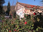
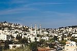
Bayt Naqquba (Arabic: بيت نقّوبة, Hebrew: בית נקובא, also spelled Bait Naqquba) was a Palestinian village in British Mandate Palestine, located 9.5 kilometers west of Jerusalem, near Abu Ghosh. Before Palmach and Haganah troops occupied the village during Operation Nachshon on April 11, 1948, approximately 300 Palestinian Arabs lived there. After the 1948 Arab–Israeli War, a moshav named Beit Nekofa was founded close to the site by Jewish immigrants from Yugoslavia. In 1962, residents of Bayt Naqubba built a new village named Ein Naqquba, south of Beit Nekofa.
Excerpt from the Wikipedia article Bayt Naqquba (License: CC BY-SA 3.0, Authors, Images).Bayt Naqquba
HaEgoz, Mate Yehuda Regional Council
Geographical coordinates (GPS) Address Nearby Places Show on map
Geographical coordinates (GPS)
| Latitude | Longitude |
|---|---|
| N 31.803055555556 ° | E 35.125833333333 ° |
Address
האגוז
HaEgoz
9574320 Mate Yehuda Regional Council
Jerusalem District, Israel
Open on Google Maps


