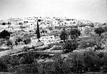
Castel National Park

Castel National Park (Hebrew: גן לאומי קסטל) is an Israeli national park, which consists of a fortified summit in the Judean Mountains, at the site of the former Palestinian village of Al-Qastal, known to Hebrew-speakers as HaCástel, "the Cástel". It is located 8 km west of Jerusalem on the road linking it to Tel Aviv (Highway 1). The site is mostly known as the place of the key battles of Operation Nachshon, which were fought there in April 1948 during the 1948 Arab–Israeli War. Fierce battles that claimed many lives took place there as Arabs and Jews fought for control of the site, which overlooked the main Tel Aviv-Jerusalem highway. Castel exchanged hands several times in the course of the fighting. The tides turned when the revered Arab commander, Abd al-Qadir al-Husayni, was killed. Many of the Arabs left their positions to attend al-Husayni's funeral at the Al-Aqsa Mosque on Friday, April 9. That same day, Castel fell to the Israeli forces virtually unopposed.The national park includes a memorial for the Israeli soldiers who died there, including a monument designed in 1980 by Yitzhak Yamin and a memorial to the convoys that tried to break through the blockade of Jerusalem.
Excerpt from the Wikipedia article Castel National Park (License: CC BY-SA 3.0, Authors, Images).Castel National Park
Keren Kayemet LeIsrael, Mevaseret Zion
Geographical coordinates (GPS) Address Nearby Places Show on map
Geographical coordinates (GPS)
| Latitude | Longitude |
|---|---|
| N 31.795661111111 ° | E 35.144191666667 ° |
Address
הקסטל
Keren Kayemet LeIsrael
9574320 Mevaseret Zion
Jerusalem District, Israel
Open on Google Maps


