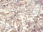
Suba, Jerusalem
Ancient Jewish settlements of JudaeaArab villages depopulated during the 1948 Arab–Israeli WarArchaeological sites in IsraelHebrew Bible placesPages with non-numeric formatnum arguments

Suba (Arabic: صوبا) was a Palestinian Arab village west of Jerusalem that was depopulated and destroyed in 1948. The site of the village lies on the summit of a conical hill called Tel Tzova (Hebrew: תל צובה), or Jabal Suba, rising 769 meters above sea level, and it was built on the ruins of a Crusader castle.
Excerpt from the Wikipedia article Suba, Jerusalem (License: CC BY-SA 3.0, Authors, Images).Suba, Jerusalem
kibbutz security road, Mate Yehuda Regional Council
Geographical coordinates (GPS) Address Nearby Places Show on map
Geographical coordinates (GPS)
| Latitude | Longitude |
|---|---|
| N 31.784722222222 ° | E 35.126111111111 ° |
Address
תל צובה
kibbutz security road
9574320 Mate Yehuda Regional Council
Jerusalem District, Israel
Open on Google Maps


