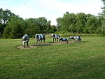
Abbey Hill
Buckinghamshire geography stubsCivil parishes in BuckinghamshireEngvarB from September 2013
Abbey Hill is a civil parish that covers the Two Mile Ash, Kiln Farm, and Wymbush districts of Milton Keynes in Buckinghamshire, England. As the first tier of Local Government, the parish council is responsible for the people, living and working in this area of Milton Keynes. The Parish was formed in 2008 as part of a revision of parishes of the Borough of Milton Keynes: the districts were previously part of a parish called Bradwell Abbey. It is bounded by Millers Way (H2), the A5, Watling Street (V4), and Dansteed Way (H4).
Excerpt from the Wikipedia article Abbey Hill (License: CC BY-SA 3.0, Authors).Abbey Hill
Pitfield, Milton Keynes Abbey Hill
Geographical coordinates (GPS) Address Phone number Website Nearby Places Show on map
Geographical coordinates (GPS)
| Latitude | Longitude |
|---|---|
| N 52.043 ° | E -0.808 ° |
Address
Abbey Hill Golf Centre
Pitfield
MK8 8AA Milton Keynes, Abbey Hill
England, United Kingdom
Open on Google Maps


