Siege of Canterbury
CanterburyConflicts in 1011Vikings

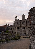
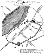
The siege of Canterbury was a major Viking raid on the city of Canterbury that occurred between 8 and 29 September 1011, fought between a Viking army led by Thorkell the Tall and the Anglo-Saxon defenders. The details of the siege are largely unknown, and most of the known events were recorded in the Anglo-Saxon Chronicle.
Excerpt from the Wikipedia article Siege of Canterbury (License: CC BY-SA 3.0, Authors, Images).Siege of Canterbury
Orange Street, Canterbury The King's Mile
Geographical coordinates (GPS) Address Nearby Places Show on map
Geographical coordinates (GPS)
| Latitude | Longitude |
|---|---|
| N 51.28 ° | E 1.08 ° |
Address
Orange Street Car Park
Orange Street
CT1 2JA Canterbury, The King's Mile
England, United Kingdom
Open on Google Maps


