place

AquaRio

Aquaria in BrazilTourist attractions in Rio de Janeiro (city)
Praça Muhammad Ali
Praça Muhammad Ali

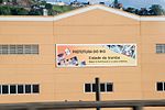
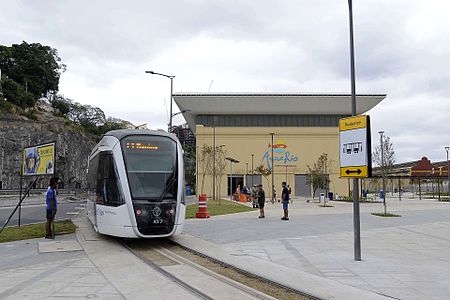
The Marine Aquarium of Rio de Janeiro (Portuguese: Aquário Marinho do Rio de Janeiro), or AquaRio, is a public aquarium located in the Gamboa neighborhood, in the port zone of Rio de Janeiro, Brazil. With a constructed area of about 26,000 square metres (280,000 sq ft), it is located to the west of Muhammad Ali Square. It is considered the largest marine aquarium in South America.It was inaugurated on October 31, 2016, in a ceremony that was attended by the former minister of Tourism, Marx Beltrão. The public aquarium was made at Porto Maravilha, an urban operation that aims to revitalize the Port Zone of Rio de Janeiro. The building occupied by AquaRio has a total of 5 floors and 28 tanks with various types of fish. In the tanks, about 4.5 million liters of salt water are stored, in addition to 8 thousand animals of 350 different species. The building formerly belonged to Companhia Brasileira de Armazenamento (Cibrazem), now Companhia Nacional de Abastecimento (CONAB).

Excerpt from the Wikipedia article AquaRio (License: CC BY-SA 3.0, Authors, Images).

AquaRio
Avenida Rodrigues Alves, Rio de Janeiro Gamboa (Zona Central do Rio de Janeiro)

Geographical coordinates (GPS) Address Website External links Nearby Places
placeShow on map

Wikipedia: AquaRioContinue reading on Wikipedia

Geographical coordinates (GPS)

Latitude Longitude
N -22.8931 ° E -43.1927 °
placeShow on map

Address

AquaRio (Aquário Marinho do Rio de Janeiro)

Avenida Rodrigues Alves
20220-360 Rio de Janeiro, Gamboa (Zona Central do Rio de Janeiro)
Rio de Janeiro, Brazil
mapOpen on Google Maps

Website
aquariomarinhodorio.com.br

linkVisit website

linkWikiData (Q28679974)
linkOpenStreetMap (378561133)

Praça Muhammad Ali
Praça Muhammad Ali
Share experience

Nearby Places

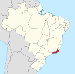
Rio de Janeiro (state)

Rio de Janeiro (Portuguese pronunciation: [ˈʁi.u dʒi ʒɐˈne(j)ɾu] (listen), [ˈʁi.u dʒɐˈ-]) is one of the 27 federative units of Brazil. It has the second largest economy of Brazil, with the largest being that of the state of São Paulo. The state, which has 8.2% of the Brazilian population, is responsible for 9.2% of the Brazilian GDP.The state of Rio de Janeiro is located within the Brazilian geopolitical region classified as the Southeast (assigned by IBGE). Rio de Janeiro shares borders with all the other states in the same Southeast macroregion: Minas Gerais (N and NW), Espírito Santo (NE) and São Paulo (SW). It is bounded on the east and south by the South Atlantic Ocean. Rio de Janeiro has an area of 43,653 km2 (16,855 sq mi). Its capital is the city of Rio de Janeiro, which was the capital of the Portuguese Colony of Brazil from 1763 to 1815, of the following United Kingdom of Portugal, Brazil and the Algarves from 1815 to 1822, and of later independent Brazil as a kingdom and republic from 1822 to 1960. The state's 22 largest cities are Rio de Janeiro, São Gonçalo, Duque de Caxias, Nova Iguaçu, Niterói, Campos dos Goytacazes, Belford Roxo, São João de Meriti, Petrópolis, Volta Redonda, Magé, Macaé, Itaboraí, Cabo Frio, Armação dos Búzios, Angra dos Reis, Nova Friburgo, Barra Mansa, Barra do Piraí, Teresópolis, Mesquita and Nilópolis. Rio de Janeiro is the smallest state by area in the Southeast macroregion and one of the smallest in Brazil. It is, however, the third most populous Brazilian state, with a population of 16 million people in 2011 (making it the most densely populated state in Brazil) and has the third longest coastline in the country (after those of the states of Bahia and Maranhão). In the Brazilian flag, the state is represented by Mimosa, the beta star in the Southern Cross (β Cru).