place

Providência, Rio de Janeiro

Geography of Rio de Janeiro (city)Rio de Janeiro (state) geography stubs

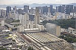
Providência is a region of Rio de Janeiro, but not officially recognized as a neighborhood.

Excerpt from the Wikipedia article Providência, Rio de Janeiro (License: CC BY-SA 3.0, Authors).

Providência, Rio de Janeiro
Rua Cruzeiro da Providência, Rio de Janeiro Gamboa

Geographical coordinates (GPS) Address Nearby Places
placeShow on map

Wikipedia: Providência, Rio de JaneiroContinue reading on Wikipedia

Geographical coordinates (GPS)

Latitude Longitude
N -22.900833333333 ° E -43.196666666667 °
placeShow on map

Address

Igreja Nossa Senhora da Providência (Capela das Almas)

Rua Cruzeiro da Providência
20221-901 Rio de Janeiro, Gamboa
Rio de Janeiro, Brazil
mapOpen on Google Maps

Share experience

Nearby Places

Rio de Janeiro (state)

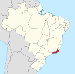
Rio de Janeiro (Portuguese pronunciation: [ˈʁi.u dʒi ʒɐˈne(j)ɾu] (listen), [ˈʁi.u dʒɐˈ-]) is one of the 27 federative units of Brazil. It has the second largest economy of Brazil, with the largest being that of the state of São Paulo. The state, which has 8.2% of the Brazilian population, is responsible for 9.2% of the Brazilian GDP.The state of Rio de Janeiro is located within the Brazilian geopolitical region classified as the Southeast (assigned by IBGE). Rio de Janeiro shares borders with all the other states in the same Southeast macroregion: Minas Gerais (N and NW), Espírito Santo (NE) and São Paulo (SW). It is bounded on the east and south by the South Atlantic Ocean. Rio de Janeiro has an area of 43,653 km2 (16,855 sq mi). Its capital is the city of Rio de Janeiro, which was the capital of the Portuguese Colony of Brazil from 1763 to 1815, of the following United Kingdom of Portugal, Brazil and the Algarves from 1815 to 1822, and of later independent Brazil as a kingdom and republic from 1822 to 1960. The state's 22 largest cities are Rio de Janeiro, São Gonçalo, Duque de Caxias, Nova Iguaçu, Niterói, Campos dos Goytacazes, Belford Roxo, São João de Meriti, Petrópolis, Volta Redonda, Magé, Macaé, Itaboraí, Cabo Frio, Armação dos Búzios, Angra dos Reis, Nova Friburgo, Barra Mansa, Barra do Piraí, Teresópolis, Mesquita and Nilópolis. Rio de Janeiro is the smallest state by area in the Southeast macroregion and one of the smallest in Brazil. It is, however, the third most populous Brazilian state, with a population of 16 million people in 2011 (making it the most densely populated state in Brazil) and has the third longest coastline in the country (after those of the states of Bahia and Maranhão). In the Brazilian flag, the state is represented by Mimosa, the beta star in the Southern Cross (β Cru).

April 2010 Rio de Janeiro floods and mudslides

The April 2010 Rio de Janeiro floods and mudslides was an extreme weather event that affected the State of Rio de Janeiro in Brazil in the first days of April 2010. At least 212 people died, 161 people have been injured (including several rescuers), while at least 15,000 people have been made homeless. A further 10,000 homes are thought to be at risk from mudslides, most of them in the favelas, the shanty towns built on the hillsides above downtowns. Damage from the flooding has been estimated at $23.76 billion reais (US$13.3bn, €9.9bn), about 8% of the gross domestic product (GDP) of Rio de Janeiro State.The flooding particularly affected the city of Rio de Janeiro, where at least 60 people died, and its surrounding area. Deaths were also reported in the cities of Niterói (132), São Gonçalo (16), Paracambi (1), Engenheiro Paulo de Frontin (1), Magé (1), Nilópolis (1) and Petrópolis (1). Several municipalities, including Niterói and municipalities to the east such as Maricá and Araruama, have declared states of emergency or of public calamity. The Governor of Rio de Janeiro State, Sérgio Cabral, declared three days of official mourning for the dead. Heavy rain started at around 5 p.m. local time (2000 UTC) on Monday April 5th in Rio de Janeiro city, and continued for 24 hours, with a total of 28.8 cm (11½ in.) of rain falling, more than was predicted for the whole of April and the heaviest rainfall for 30 years. The Brazilian TV station Globo said the rainfall was equivalent to 300,000 Olympic swimming pools of water. There were drivers who were forced to sleep in their cars. There were also firemen who used rubber dinghies to rescue passengers from stranded buses, and shopkeepers who worked very quickly to prevent the rainfall from destroying their businesses.Rio de Janeiro mayor Eduardo Paes admitted that the city's preparedness for heavy rainfall had been "less than zero," but added "there isn’t a city that wouldn’t have had problems with this level of rainfall."A further landslide hit a slum in Niterói late on April 7. It is thought to have killed at least 150 people. Around 200 people were missing in the town as of April 13th, 2010.After nearly 300 landslides hit the area, the statue of Christ the Redeemer was cut off from traffic for the first time in history.More than 300 homes were bulldozed after the landslides, and it is estimated that close to 12,000 families will need to be relocated by 2012 due to the damage from the floods.

Brazilian National Archives

The National Archives of Brazil (Portuguese: Arquivo Nacional, AN) were created in 1838 as the Imperial Public Archives. The Archives were renamed in 1911, and are located in Rio de Janeiro. The National Archives of Brazil is the Brazilian institution responsible for the management, preservation and dissemination of federal government documents. Since 2011, it is subordinated to the Ministry of Justice and Public Security. The AN has the following responsibilities, according to the Decree No. 9,360 of May 7, 2018, which grants it as the main body of Archival Documents Management System (in Portuguese: Sistema de Gestão de Documentos de Arquivo – SIGA) of the federal government: "to guide the main organizations and entities of the federal Executive Power in the implementation of document management programs; oversee the application of procedures and technical operations related to the production, registration, classification, control of the processing, use and evaluation of documents, to modernize government archival services; promote the collection of permanent guard documents for technical treatment, preservation and dissemination, to guarantee full access to information, in support of governmental decisions of a political–administrative nature and to the citizen in the defense of their rights, aiming to encourage the production of scientific and cultural knowledge; and supervise and apply the national policy archives, established by the National Council of Archives (Conselho Nacional de Arquivo – CONARQ)".The National Archives of Brazil thus fulfills a double and essential function for the Brazilian State and society – both in the management of archival documents that are produced in all federal institutions and in safeguarding and giving access to fundamental fonds for history.