East Dundry
Hamlets in Somerset

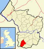
East Dundry is a south-facing hamlet some 160 metres above sea level in a sheltered valley of Dundry Hill just south of Bristol, England. The hamlet is in the parish of Dundry and about two kilometres east of its village church. The iron-age Maes Knoll tump (2.5 kilometres to the east) and tumuli (in the field just north-east of North Hill Farm) are evidence of long occupation of the valley.
Excerpt from the Wikipedia article East Dundry (License: CC BY-SA 3.0, Authors, Images).East Dundry
Spring Lane,
Geographical coordinates (GPS) Address Nearby Places Show on map
Geographical coordinates (GPS)
| Latitude | Longitude |
|---|---|
| N 51.393 ° | E -2.612 ° |
Address
Spring Lane
Spring Lane
BS41 8NT
England, United Kingdom
Open on Google Maps


