place

Winnats Pass

Canyons and gorges of EnglandCastleton, DerbyshireDerbyshire geography stubsLandforms of DerbyshireMountain passes of England
National Trust properties in DerbyshirePeak DistrictScenic routes in the United KingdomTransport in DerbyshireUse British English from June 2023
WinnatsPass
WinnatsPass

Winnats Pass (or Winnats, as shown on some Ordnance Survey maps) is a hill pass and limestone gorge in the Peak District of Derbyshire, England. The name is a corruption of 'wind gates' due to the swirling winds through the pass. It lies west of the village of Castleton, in the National Trust's High Peak Estate and the High Peak borough of Derbyshire. The road winds through a cleft, surrounded by high limestone ridges. At the foot of the pass is the entrance to Speedwell Cavern, a karst cave accessed through a flooded lead mine, and which is a popular tourist attraction.In the 1930s, Winnats Pass was the location used for annual access rallies in support of greater access to the moorlands or the Peak District, around the time of the Mass Trespass of Kinder Scout. At their peak these were attended by up to 10,000 people.The permanent closure of the main A625 road at Mam Tor in 1979 due to subsidence has resulted in Winnats Pass being heavily used by road traffic. However, the narrowness of the road and its maximum gradient of over 28% (1 in 3+1⁄2) has caused it to be closed to buses, coaches and vehicles over 7.5 tonnes in weight. The road regularly features in the Tour of the Peak cycle race each autumn.

Excerpt from the Wikipedia article Winnats Pass (License: CC BY-SA 3.0, Authors, Images).

Winnats Pass
Winnats Pass, High Peak Castleton

Geographical coordinates (GPS) Address Nearby Places
placeShow on map

Wikipedia: Winnats PassContinue reading on Wikipedia

Geographical coordinates (GPS)

Latitude Longitude
N 53.34013 ° E -1.79871 °
placeShow on map

Address

Winnats Pass (Winnats Road)

Winnats Pass
S33 8WA High Peak, Castleton
England, United Kingdom
mapOpen on Google Maps

WinnatsPass
WinnatsPass
Share experience

Nearby Places

Speedwell Cavern
Speedwell Cavern

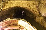
Speedwell Cavern is one of the four show caves in Castleton, Derbyshire, England.The cave system consists of a horizontal lead miners' adit (a level passageway driven horizontally into the hillside) 200 metres (660 ft) below ground leading to the cavern itself, a limestone cave. The narrow adit is permanently flooded, so after descending a long staircase, access to the cave is made by boat. At the end of the adit, the cavern opens up with fluorspar veins, stalactites and stalagmites, and the so-called "Bottomless Pit". This chamber has an underground lake with a 20 metres (66 ft) high waterfall and an extremely deep vertical shaft, now choked to within 20 metres (66 ft) of the surface by rock spoil dumped by miners, after driving the continuation of the canal to the natural streamway beyond, which provided the bulk of the water for the canal. The original depth of the shaft has been estimated, from the amount of spoil placed in the shaft over the years, at around 150 metres (490 ft).The mine was developed in the 1770s but the limited lead ore deposits meant that it was not profitable and it was closed down by 1790.At the foot of Winnats Pass, it is a tourist attraction with an underground boat trip to the cavern. Originally the guide propelled the boat by pushing against the walls with his hands, later the boat was legged through, and now it is powered by an electric motor. A connection was discovered in 2006 between the Speedwell Cavern system and Titan, the largest natural shaft in the UK, which is 141.5 metres (464 ft) high.