place

Titan (cave)

Caves of DerbyshireUse British English from June 2023Wild caves
SpeedwellCavern
SpeedwellCavern

Titan is a natural cavern near Castleton in the Derbyshire Peak District, and is the deepest shaft of any known cave in Britain, at 141.5 metres (464 ft). The existence of Titan was revealed in November 2006, following its discovery on 1 January 1999 after cavers discovered connections from the James Hall Over Engine Mine to both Speedwell Cavern and Peak Cavern. Previously, the deepest known underground shaft in Britain had been Gaping Gill on the slopes of Ingleborough in the Yorkshire Dales. A group of Peak District cavers discovered the shaft after finding an account by an 18th-century academic, James Plumtree, in a university library. Initial explorations in the James Hall Over Engine Mine led to the discovery of a large shaft named Leviathan, before further excavations revealed the existence of Titan.

Excerpt from the Wikipedia article Titan (cave) (License: CC BY-SA 3.0, Authors, Images).

Titan (cave)
Dirtlow Rake, High Peak Castleton

Geographical coordinates (GPS) Address Nearby Places
placeShow on map

Wikipedia: Titan (cave)Continue reading on Wikipedia

Geographical coordinates (GPS)

Latitude Longitude
N 53.333358333333 ° E -1.7932916666667 °
placeShow on map

Address

Titan Shaft

Dirtlow Rake
S33 8WU High Peak, Castleton
England, United Kingdom
mapOpen on Google Maps

SpeedwellCavern
SpeedwellCavern
Share experience

Nearby Places

Speedwell Cavern
Speedwell Cavern

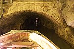
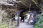
Speedwell Cavern is one of the four show caves in Castleton, Derbyshire, England.The cave system consists of a horizontal lead miners' adit (a level passageway driven horizontally into the hillside) 200 metres (660 ft) below ground leading to the cavern itself, a limestone cave. The narrow adit is permanently flooded, so after descending a long staircase, access to the cave is made by boat. At the end of the adit, the cavern opens up with fluorspar veins, stalactites and stalagmites, and the so-called "Bottomless Pit". This chamber has an underground lake with a 20 metres (66 ft) high waterfall and an extremely deep vertical shaft, now choked to within 20 metres (66 ft) of the surface by rock spoil dumped by miners, after driving the continuation of the canal to the natural streamway beyond, which provided the bulk of the water for the canal. The original depth of the shaft has been estimated, from the amount of spoil placed in the shaft over the years, at around 150 metres (490 ft).The mine was developed in the 1770s but the limited lead ore deposits meant that it was not profitable and it was closed down by 1790.At the foot of Winnats Pass, it is a tourist attraction with an underground boat trip to the cavern. Originally the guide propelled the boat by pushing against the walls with his hands, later the boat was legged through, and now it is powered by an electric motor. A connection was discovered in 2006 between the Speedwell Cavern system and Titan, the largest natural shaft in the UK, which is 141.5 metres (464 ft) high.

Cave Dale
Cave Dale

Cave Dale (sometimes spelt Cavedale) is a dry limestone valley in the Derbyshire Peak District, England. It is located at grid reference SK149824. The northern end of the dale starts at the village of Castleton where the valley sides are almost perpendicular and over 50 metres (160 ft) in height. The dale rises gently after leaving Castleton for approximately 200 metres (220 yd) before becoming steeper culminating in a fine viewpoint down the dale taking in Peveril Castle with Lose Hill behind (see picture). After the viewpoint the dale swings west and levels out with gentle gradients, becoming just a shallow depression as it peters out onto the open pastureland between Castleton and Chapel-en-le-Frith.Cave Dale was initially formed by glacial meltwater carving a deep narrow valley in the local soluble limestone. The river then found a route underground leaving a dry valley with caverns underneath. Later on the caverns below Cave Dale collapsed making the valley even deeper and gorge-like at the northern end. The Castleton entrance to Cave Dale had a narrow natural arch as recently as 200 years ago, a relic of the roof collapse. The lower slopes of the dale have large amounts of scree, frost on the higher limestone cliffs having caused the rock to shatter. Halfway up the valley is an outcrop of basaltic lava with a few small columns. Although relatively small, the lava forms a hydrological barrier, creating an 'umbrella' effect in Peak Cavern below, preventing speleothem production beneath the bed. A bridleway runs the entire length of the dale, part of the Limestone Way footpath which travels 80 kilometres from Castleton to Rocester in Staffordshire. Cave Dale is accessed through a narrow rocky opening almost from the centre of Castleton, and Peveril Castle is seen high up on the almost vertical western slopes. The Normans chose this site because the steep sides of Cave Dale gave a natural defence and good lookout. The chambers and caves of Peak Cavern run directly below Cave Dale and any small streams in the dale quickly disappear into the ground down limestone fissures and into the caverns beneath. Mineral veins can also be seen within the limestone of the dale. The cliffs at the northern end of Cave Dale are used by rock climbers and there are several routes in the Very Severe category. There are several small caves or old lead mines within the dale's limestone walls, one being larger than the rest with bars preventing access, as it is the ventilation fan outlet for Peak Cavern. Cave Dale's steep north-facing grassy slopes are damp and bryophyte-rich and are dominated by oat grass (Trisetum flavescent) and sheep's fescue (Festuca ovina). Lesser meadow-rue (Thalictrum minus) grows extensively on ledges in the dale.At the southwestern extremity of the dale as it merges into the moorland between Castleton and Peak Forest are the remains of several old lead mines. The Hazard Mine lies at grid reference SK136812, and was one of the major mines of the area. Over 5000 tonnes of lead ore were mined and the workings once went down to 700 feet (210 m), though the main shaft is now only 80m deep after internal collapses. The Hollandtwine Mine lies 250 metres (820 ft) to the east but the shaft top was destroyed and buried during fluorspar quarrying in the 1990s, and access is no longer possible. Drainage from both mines went directly into Peak Cavern.In 1983 Cave Dale was the scene of the murder of a 21-year-old Manchester Polytechnic student, Susan Renhard. Norman Smith, a local 17-year-old, was subsequently jailed for life at Nottingham Crown Court in 1984. Cave Dale features in the films The Princess Bride (1987) and The Other Boleyn Girl (2008).