place

Westbourne Bridge

Bridges completed in 1909Grade II listed bridges in LondonGrade II listed buildings in the City of WestminsterPaddingtonRoad bridges in England
United Kingdom bridge (structure) stubsWestbourne, London
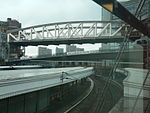
Paddington, Westbourne Bridge geograph.org.uk 630249

Westbourne Bridge is a grade II listed road bridge in the City of Westminster, London. It was built some time after 1909 for the Great Western Railway.It carries road traffic over the railway lines in and out of Paddington Station and is joined at its northern end by Westbourne Terrace Road and at the south end by Westbourne Terrace. However, northbound road traffic has not been able to travel between the bridge and Westbourne Terrace Road since 1970. Northbound traffic has been diverted on to Harrow Road running under the elevated roadway of the Westway for a short distance. Southbound traffic using the bridge comes from the eastbound sliproad descending from the Westway.

Excerpt from the Wikipedia article Westbourne Bridge (License: CC BY-SA 3.0, Authors, Images).

Westbourne Bridge
Kingdom Street, London Paddington

Geographical coordinates (GPS) Address Website Nearby Places
placeShow on map

Wikipedia: Westbourne BridgeContinue reading on Wikipedia

Geographical coordinates (GPS)

Latitude Longitude
N 51.5188 ° E -0.183 °
placeShow on map

Address

Novotel London Paddington

Kingdom Street 3
W2 6BD London, Paddington
England, United Kingdom
mapOpen on Google Maps

Website
novotel.com

linkVisit website

Paddington, Westbourne Bridge geograph.org.uk 630249
Share experience

Nearby Places

Hallfield Estate
Hallfield Estate

The Hallfield Estate, owned by Westminster City Council, is one of several modernist housing projects in Bayswater, London designed in the immediate postwar period by the Tecton architecture practice, led by Berthold Lubetkin. Following the dissolution of Tecton, the project was realised by Denys Lasdun and Lindsay Drake in the 1950s. Construction took place in two phases during 1951–55 and 1955–58. The estate is at grid reference TQ260812, south of Bishops Bridge Road in Bayswater. It comprises 15 blocks spread over roughly 17 acres (69,000 m2), a laundry (now used as the local Estate Office), and the Hallfield Primary School, also by Lasdun. Architecturally, the design shares much with similar Tecton projects of the period, including the Priory Green and Spa Green Estates, and the Finsbury Health Centre. Hallfield was designated a conservation area by Westminster City Council in 1990, and the majority of Estate buildings were listed Grade II in June 2011. John Penrose, the Minister responsible for the 2011 listing, commented: "These blocks show real flair and beauty, and all the more so considering the post-war era in which they were conceived. Sixty years on, they have become a distinctive part of the London landscape, still looking good and remaining popular with residents and visitors alike." Hannah Parham, the English Heritage Designation Advisor, responded to the 2011 listing decision by adding: “The estate presents a convincing riposte to criticism that postwar council housing is grey, drab and utilitarian. At Hallfield, the exteriors of each block are treated like works of abstract art – some are patterned with a chequerboard of blue and red brickwork; others have a zigzagging screen of white concrete panels. The estate now exists amongst an elite group of 16 listed post-war housing estates in London – estates that are successful as places to live and are cared for by their residents.”