place

Miller Farmstead (Penwell, New Jersey)

Commercial buildings completed in 1830Greek Revival architecture in New JerseyHistoric districts on the National Register of Historic Places in New JerseyLebanon Township, New JerseyMansfield Township, Warren County, New Jersey
NRHP infobox with nocatNational Register of Historic Places in Hunterdon County, New JerseyNational Register of Historic Places in Warren County, New JerseyNew Jersey Register of Historic PlacesStone arch bridgesUse mdy dates from August 2023
MILLER FARMSTEAD, HUNTERDON & WARREN COUN TIES, NJ

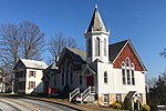
The Miller Farmstead is a historic district encompassing the main farm complex on Route 57, at Watters Road, in Mansfield Township, Warren County, New Jersey and extending into Lebanon Township, Hunterdon County. The farmstead is near the community of Penwell and overlooks the Musconetcong River, arranged linearly along the upper edge of the river's flood plain. It was added to the National Register of Historic Places on September 11, 1989, for its significance in agriculture, architecture, and transportation from 1830 to 1924. The listing is a 108 acres (44 ha) area that includes eight contributing buildings, seven contributing structures, and a contributing site.The main farmhouse, at the intersection of Route 57 and Watters Road, shows Greek Revival style. It was likely built in the 1830s or 1840s. One of the contributing structures is a triple-arch stone bridge, the Old Turnpike Road over Musconetcong River bridge. The bridge spans into Lebanon Township in Hunterdon County. It was built in 1860 by J.C. Miller and J.A. Skinner, according to a marble plaque on one of the sidewalls.

Excerpt from the Wikipedia article Miller Farmstead (Penwell, New Jersey) (License: CC BY-SA 3.0, Authors, Images).

Miller Farmstead (Penwell, New Jersey)
Watters Road, Mansfield Township

Geographical coordinates (GPS) Address Nearby Places
placeShow on map

Wikipedia: Miller Farmstead (Penwell, New Jersey)Continue reading on Wikipedia

Geographical coordinates (GPS)

Latitude Longitude
N 40.785833333333 ° E -74.895 °
placeShow on map

Address

Watters Road 5
07865 Mansfield Township
New Jersey, United States
mapOpen on Google Maps

MILLER FARMSTEAD, HUNTERDON & WARREN COUN TIES, NJ
Share experience

Nearby Places

Mansfield Township School District

The Mansfield Township School District is a community public school district that serves students in pre-kindergarten through sixth grade from Mansfield Township, in Warren County, New Jersey, United States.As of the 2018–19 school year, the district, comprised of one school, had an enrollment of 607 students and 56.8 classroom teachers (on an FTE basis), for a student–teacher ratio of 10.7:1.The district is classified by the New Jersey Department of Education as being in District Factor Group "FG", the fourth-highest of eight groupings. District Factor Groups organize districts statewide to allow comparison by common socioeconomic characteristics of the local districts. From lowest socioeconomic status to highest, the categories are A, B, CD, DE, FG, GH, I and J.Public school students in seventh through twelfth grades attend the schools of the Warren Hills Regional School District, which also serves students from the municipalities of Franklin Township, Washington Borough and Washington Township, along with those from Oxford Township (for 9-12 only, attending on a tuition basis). Schools in the district (with 2018–19 enrollment data from the National Center for Education Statistics) are Warren Hills Regional Middle School with 542 students in grades 7 and 8 (located in Washington Borough) and Warren Hills Regional High School with 1,205 students in grades 9 - 12 (located in Washington Township).