Ponkapoag Pond

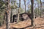
Ponkapag Pond is a 203-acre impoundment in the Blue Hills Reservation. The pond is located on the border of Canton and Randolph, Massachusetts about a half mile south of Route 128 and a half mile east of Route 138. It has a maximum depth of seven feet and an average depth of four feet. As would be expected on a pond this shallow, aquatic vegetation is pervasive and very abundant. Only a small portion of the eastern shoreline is developed; the southeastern and western shores are bordered by large expanses of marshland. A walking trail circles the pond, with parking at three locations.The name comes from a Native American word meaning a spring that bubbles up from red soil, sweet water, or shallow pond.
Excerpt from the Wikipedia article Ponkapoag Pond (License: CC BY-SA 3.0, Authors, Images).Ponkapoag Pond
Acton Path,
Geographical coordinates (GPS) Address Nearby Places Show on map
Geographical coordinates (GPS)
| Latitude | Longitude |
|---|---|
| N 42.1925 ° | E -71.095 ° |
Address
Acton Path
Acton Path
02187
Massachusetts, United States
Open on Google Maps


