Leominster State Forest
1922 establishments in MassachusettsCivilian Conservation Corps in MassachusettsMassachusetts state forestsParks in Worcester County, MassachusettsProtected areas established in 1922 ... and 1 more
Use mdy dates from October 2022

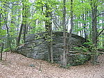
Leominster State Forest is a publicly owned forest with recreational features covering 4,246 acres (1,718 ha) in the Massachusetts towns of Leominster, Fitchburg, Princeton, Sterling, and Westminster. The state forest encompasses an extensive trail system, numerous small ponds, and the Crow Hills. Plants such as mountain laurel are common as is an abundance of wildlife. The forest is headquarters for Massachusetts Bureau of Forest Fire Control District 8 and is managed by the Department of Conservation and Recreation.
Excerpt from the Wikipedia article Leominster State Forest (License: CC BY-SA 3.0, Authors, Images).Leominster State Forest
Elm Street, Leominster
Geographical coordinates (GPS) Address Website External links Nearby Places Show on map
Geographical coordinates (GPS)
| Latitude | Longitude |
|---|---|
| N 42.520833333333 ° | E -71.838333333333 ° |
Address
Leominster State Forest
Elm Street
01453 Leominster
Massachusetts, United States
Open on Google Maps


