Parish of Manly Cove
New South Wales geography stubsParishes of Cumberland CountySydney geography stubs

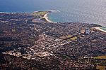
The Parish of Manly Cove is a civil parish of the County of Cumberland on the northern beaches of Sydney and covers numerous suburbs including Fairlight, Frenchs Forrest, Forestville, Kilarney Heights, Dee why, Davidson, Manly and Bookvale. The boundaries of the parish are the Pacific Ocean to the east, Middle Harbour Creek to the west, Sydney Harbour to the south and Narrabeen Lagoon on the north. Much of the parish is residential in a nature with large tracts of National Park.
Excerpt from the Wikipedia article Parish of Manly Cove (License: CC BY-SA 3.0, Authors, Images).Parish of Manly Cove
Condamine Street, Sydney Manly Vale
Geographical coordinates (GPS) Address Nearby Places Show on map
Geographical coordinates (GPS)
| Latitude | Longitude |
|---|---|
| N -33.781666666667 ° | E 151.26777777778 ° |
Address
Condamine Street
Condamine Street
2093 Sydney, Manly Vale
New South Wales, Australia
Open on Google Maps


