place

The Bloody Spring

French and Indian WarHistoric sites in PennsylvaniaPennsylvania geography stubs

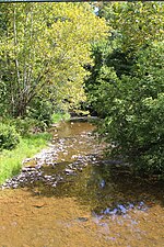
The Bloody Spring is a historical site in the Sunbury, Pennsylvania area. Located on school district property, it is purported to be the location where a soldier from Fort Augusta that was guarding cattle was ambushed and murdered by a Native American tribe member in 1756, during the French and Indian War. His blood is said to have colored the water in the spring red, resulting in the name, The Bloody Spring. The site, located on Memorial Drive and .1 miles south of Shikellamy Avenue, is marked with a historical marker.

Excerpt from the Wikipedia article The Bloody Spring (License: CC BY-SA 3.0, Authors).

The Bloody Spring
Memorial Drive, Upper Augusta Township

Geographical coordinates (GPS) Address Nearby Places
placeShow on map

Wikipedia: The Bloody SpringContinue reading on Wikipedia

Geographical coordinates (GPS)

Latitude Longitude
N 40.875316666667 ° E -76.779783333333 °
placeShow on map

Address

Memorial Drive 374
17801 Upper Augusta Township
Pennsylvania, United States
mapOpen on Google Maps

Share experience

Nearby Places

Sunbury, Pennsylvania

Sunbury ( SUN-berr-ee), Pennsylvania, is a city that serves as the county seat of Northumberland County. Nestled in the heart of Central Pennsylvania's picturesque Susquehanna Valley, Sunbury is strategically positioned on the east bank of the Susquehanna River. This location is notably downstream from where the river's main and west branches converge, adding to the city's scenic beauty and historical significance. Sunbury's roots stretch back to the early 18th century, reflecting a rich tapestry of American history. As of the 2010 census, it had a population of 9,905, illustrating its role as a significant community within the region. The city is not only the principal city of the Sunbury, PA Micropolitan Statistical Area but also plays a key role as one of the three principal cities in the larger Bloomsburg-Berwick-Sunbury, PA Combined Statistical Area. One of Sunbury's most notable historical highlights is its connection to the legendary inventor Thomas Edison. In 1883, the Hotel Edison became the first building in Sunbury to be illuminated by Edison's innovative three-wire electrical system. This event was so momentous that the hotel was later named in honor of Edison. The historical significance of this moment is further accentuated by the story of John W. Treadwell, Jr., a nine-year-old boy who had the honor of flipping the switch to activate the new lights, marking a new era in the city's development.Beyond its electrical history, Sunbury is home to several other historic landmarks. These include the Beck House and the Northumberland County Courthouse, both of which are steeped in architectural and historical value. The Sunbury Historic District, another key feature of the city, is proudly listed on the National Register of Historic Places, showcasing the city's commitment to preserving its rich heritage. Today, Sunbury continues to blend its historical legacy with modern living, offering residents and visitors alike a unique glimpse into both the past and the future. Its strategic location, historical significance, and enduring charm make Sunbury a noteworthy and beloved part of Pennsylvania's landscape.

Joseph Priestley House

The Joseph Priestley House was the American home of eighteenth-century British theologian, Dissenting clergyman, natural philosopher (and co-discoverer of oxygen), educator, and political theorist Joseph Priestley (1733–1804) from 1798 until his death. Located in Northumberland, Pennsylvania, the house, which was designed by Priestley's wife Mary, is Georgian with Federalist accents. The Pennsylvania Historical and Museum Commission (PHMC) operated it as a museum dedicated to Joseph Priestley from 1970 to August 2009, when it closed due to low visitation and budget cuts. The house reopened in October 2009, still owned by the PHMC but operated by the Friends of Joseph Priestley House (FJPH). Fleeing religious persecution and political turmoil in Britain, the Priestleys emigrated to the United States in 1794 seeking a peaceful life. Hoping to avoid the political troubles that had plagued them in Britain and the problems of urban life they saw in the United States, the Priestleys built a house in rural Pennsylvania. Nevertheless, political disputes and family troubles dogged Priestley during the last ten years of his life. After the Priestleys died, their home remained in private hands until the turn of the twentieth century, when George Gilbert Pond, a professor from what is now Pennsylvania State University, bought it and attempted to found the first Priestley museum. He died before he could complete the project and it was not until the 1960s that the house was first carefully restored by the PHMC and designated a National Historic Landmark. A second renovation was undertaken in the 1990s to return the home to the way it looked during Priestley's time. The home has been a frequent place of celebration for the American Chemical Society; they commemorated the centennial and bicentennial of the discovery of oxygen gas by Priestley as well as the 250th anniversary of Priestley's birth.

Pennsylvania Canal (West Branch Division)

The West Branch Division of the Pennsylvania Canal ran 73 miles (117 km) from the canal basin at Northumberland, Pennsylvania, at the confluence of the West Branch Susquehanna River with the main stem of the Susquehanna River, north through Muncy, then west through Williamsport, Jersey Shore, and Lock Haven to its terminus in Farrandsville. At its southern terminus in the Northumberland basin, the West Branch Canal met the North Branch Canal and the Susquehanna Division Canal. Through these connections to other divisions of the Pennsylvania Canal, it formed part of a multi-state water transportation system including the Main Line of Public Works.Between Northumberland and Muncy, the canal lay east of the river. Beyond Muncy, where the river makes a right-angle turn, the canal lay to the north. Started in 1828 and completed in 1835, it had 19 lift locks overcoming a total vertical rise of about 140 feet (43 m). The locks, beginning with No. 13, slightly upstream of the Northumberland Canal Basin, and ending with No. 34 at Lockport, across the river from Lock Haven, included two guard locks and an outlet lock in addition to the 19 lift locks.The state intended to extend the West Branch Canal from Farrandsville further upstream along the West Branch Susquehanna River to the mouth of Sinnemahoning Creek. Plans called for 33 miles (53 km) of canal, but the project was abandoned along with the idea that the West Branch Canal would eventually connect to the Allegheny River in western Pennsylvania.