Étang de Thau
Bodies of water of FranceCanal du MidiGulf of LionLagoons of EuropeLakes of Hérault ... and 1 more
Pages with French IPA

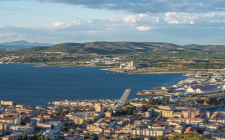
The Étang de Thau (French pronunciation: [etɑ̃ də to]; Occitan: Estanh de Taur) or Bassin de Thau is the largest of a string of lagoons (étangs) that stretch along the French coast from the Rhône river to the foothills of the Pyrenees and the border to Spain in the Languedoc-Roussillon. Although it has a high salinity, it is considered the second largest lake in France.
Excerpt from the Wikipedia article Étang de Thau (License: CC BY-SA 3.0, Authors, Images).Étang de Thau
Geographical coordinates (GPS) Address Nearby Places Show on map
Geographical coordinates (GPS)
| Latitude | Longitude |
|---|---|
| N 43.41 ° | E 3.6241666666667 ° |
Address
34140
Occitania, France
Open on Google Maps


