place

Stutton, Suffolk

Babergh DistrictCivil parishes in SuffolkSuffolk geography stubsVillages in Suffolk
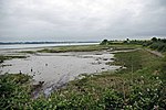
Stutton Church, Suffolk geograph.org.uk 861854

Stutton is a small village and a civil parish approximately seven miles south of Ipswich in Suffolk, United Kingdom, on the Shotley peninsula. The village has two pubs, a community shop, a primary school, a village hall, a vets and a hair salon, an 18th-century period self-catering holiday cottage, bed and breakfast, and a holistic therapy centre. The village church of St. Peter's lies almost a mile from the village centre. The village is home to Stutton Hall, a 16th-century Tudor house. Stutton Hall was built by Sir Edmund Jermy (Knight) c. 1550. The hall is a red-brick house composed of an older east wing and a newer west wing. Stutton is surrounded by farming country. Close to the village lies Alton Water reservoir, popular for windsurfing and sailing, and about two miles east of Stutton in the neighbouring village of Holbrook is the Royal Hospital School. Stutton has two pubs: the Kings Head and the Gardeners Arms. They are both bars and restaurants.

Excerpt from the Wikipedia article Stutton, Suffolk (License: CC BY-SA 3.0, Authors, Images).

Stutton, Suffolk
Alton Hall Lane, Babergh

Geographical coordinates (GPS) Address Nearby Places
placeShow on map

Wikipedia: Stutton, SuffolkContinue reading on Wikipedia

Geographical coordinates (GPS)

Latitude Longitude
N 51.971 ° E 1.129 °
placeShow on map

Address

Alton Hall Lane
IP9 2SN Babergh
England, United Kingdom
mapOpen on Google Maps

Stutton Church, Suffolk geograph.org.uk 861854
Share experience

Nearby Places

Royal Hospital School

The Royal Hospital School (usually shortened as "RHS" and historically nicknamed "The Cradle of the Navy") is a British co-educational fee-charging boarding and day school with naval traditions. The school admits pupils from age 11 to 18 (Years 7 to 13) through Common Entrance or the school's own exam. The school is regulated by Acts of Parliament.The school is located in the village of Holbrook, near Ipswich, Suffolk, England. The school's campus is of Queen Anne style and set in 200 acres (0.81 km2) countryside overlooking the River Stour, Suffolk on the Shotley Peninsula in an area known as Constable Country. The Royal Hospital School was established by a royal charter in 1712. It was originally located at Greenwich Hospital in Greenwich. The school moved in 1933 to East Anglia. The school is the only United Kingdom independent boarding school to have ever been continuously granted the Queen's Banner and it flies its own Admiralty-approved Royal Hospital School Blue Ensign. It is one of only two UK schools whose students have the privilege of wearing Royal Navy uniforms, the other being Pangbourne College in Berkshire. The school is affiliated to the Headmasters' and Headmistresses' Conference (HMC). Bernard de Neumann, a former pupil, described the school's significance as such: "Just as, according to the Duke of Wellington, the Battle of Waterloo was won on the playing fields of Eton, it may justifiably be claimed, that the establishment of... the British Empire, was charted and plotted in the classroom of... the Royal Hospital School."

Freston (causewayed enclosure)

Freston is a Neolithic causewayed enclosure, an archaeological site near the village of Freston in Suffolk, England. Causewayed enclosures were built in England from shortly before 3700 until at least 3500 BC; they are characterised by the full or partial enclosure of an area with ditches that are interrupted by gaps, or causeways. Their purpose is not known; they may have been settlements, meeting places, or ritual sites. The Freston enclosure was first identified in 1969 from cropmarks in aerial photographs. At 8.55 ha (21.1 acres) it is one of the largest causewayed enclosures in Britain, and would have required thousands of person-days to construct. The cropmarks show an enclosure with two circuits of ditches, and a palisade that ran between the two circuits. There is also evidence of a rectangular structure in the northeastern part of the site, which may be a Neolithic longhouse or an Anglo-Saxon hall. In 2018, a group from McMaster University organized a research project focused on the site, beginning with a geophysical survey and a pedestrian survey to collect any items of archaeological interest from the surface of the site. This was followed by an excavation in 2019 which recovered some Neolithic material and obtained radiocarbon dates indicating that the site was constructed some time in the mid-4th millennium BC. Other finds included oak charcoal fragments believed to come from the palisade, and evidence of a long ditch to the southeast that probably predated the enclosure, and which may have accompanied a long barrow, a form of Neolithic burial mound. The site has been protected as a scheduled monument since 1976.