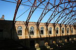
Horton, Surrey
Horton is a semi-rural area with a village centre in the west of the borough of Epsom and Ewell, in the English county of Surrey. It is situated between the settlements of Epsom, West Ewell, Chessington and Malden Rushett. Its principal road is Horton Lane, which runs the length of the area between West Ewell and Epsom Common. Horton covers the west part of the KT19 postcode which comes under part of the Epsom postal area. Horton Country Park also runs along the length of the area, between Epsom Common and West Ewell. The place-name Horton is relatively common in England. It derives from Old English horu 'dirt' and tūn 'settlement, farm, estate', presumably meaning 'farm on muddy soil'. It gave its name to the Horton Light Railway which served a number of the psychiatric hospitals in the area during the 20th century, collectively known as the Epsom Cluster. Since the start of the 21st century, Horton has undergone rapid change. The hospitals which made up the Epsom Cluster closed as Care in the Community took over from inpatient care. Multiple housing estates including Manor Park were constructed on the site, in addition to a number of shops in the centre of the area. In 2022, Horton was made a ward in its own right of Epsom and Ewell due to the population increase in the area.
Excerpt from the Wikipedia article Horton, Surrey (License: CC BY-SA 3.0, Authors).Horton, Surrey
McKenzie Way, Epsom and Ewell
Geographical coordinates (GPS) Address Nearby Places Show on map
Geographical coordinates (GPS)
| Latitude | Longitude |
|---|---|
| N 51.347 ° | E -0.285 ° |
Address
McKenzie Way
McKenzie Way
KT19 7NN Epsom and Ewell
England, United Kingdom
Open on Google Maps


