place

Brewster station

1848 establishments in New York (state)Former New York Central Railroad stationsMetro-North Railroad stations in New York (state)Railway stations in Putnam County, New YorkRailway stations in the United States opened in 1848
Transportation in Dutchess County, New YorkU.S. Route 6
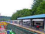
Brewster, New York station building

Brewster station is a commuter rail stop on the Metro-North Railroad's Harlem Line, located in Brewster, New York. It is the southernmost station in Putnam County. Trains leave for New York City every hour, and about every 25 minutes during rush hour. It is 52 miles (83.7 km) from Grand Central Terminal and travel time there is approximately one hour, 22 minutes. The station is located in the Zone 7 Metro-North fare zone. A sizable amount of the station's ridership comes from across the Connecticut state line given the quicker trips, shorter headways, and (outside peak hours) lack of a mid-trip transfer to Grand Central as opposed to taking the Danbury Branch of the New Haven Line. Because of this, Housatonic Area Regional Transit (the Greater Danbury-area mass transit provider) has a route and a shuttle connecting Danbury to Brewster station.

Excerpt from the Wikipedia article Brewster station (License: CC BY-SA 3.0, Authors, Images).

Brewster station
Railroad Avenue, Town of Southeast

Geographical coordinates (GPS) Address External links Nearby Places
placeShow on map

Wikipedia: Brewster stationContinue reading on Wikipedia

Geographical coordinates (GPS)

Latitude Longitude
N 41.3947 ° E -73.6198 °
placeShow on map

Address

Brewster

Railroad Avenue 401
10509 Town of Southeast
New York, United States
mapOpen on Google Maps

linkWikiData (Q4962733)
linkOpenStreetMap (1034657985)

Brewster, New York station building
Share experience

Nearby Places

Diverting Reservoir

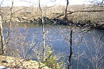
The Diverting Reservoir is a reservoir in the New York City water supply system in the town of Southeast, New York, in Putnam County immediately south of the village of Brewster, New York. Part of the system's Croton Watershed, it lies about 50 miles (80 km) north of New York City. Construction impounding the East Branch Croton River began early in the 20th century and was completed by 1911. The Diverting reservoir holds 900 million US gallons (3,400,000 m3) of water at full capacity, making it the smallest in New York City's water supply outside the City itself. Its drainage basin represents 8 square miles (21 km2) of the Croton River watershed. This basin includes the lakes, streams, rivers, and other bodies of water that flow into the reservoir. The Diverting Reservoir is also connected to the nearby Croton Falls Reservoir via a channel and dividing weir allowing water to freely pass between. The water in Diverting Reservoir flows into the continuation of the East Branch, which then joins the flow of the West Branch, itself carrying the flow of the Middle Branch, amid the headwaters of the Muscoot Reservoir, the collecting point for most of the Croton Watershed. It continues into the New Croton Reservoir, the final collecting point, then the New Croton Aqueduct. Water from the Aqueduct flows into the Jerome Park Reservoir. In January 2007, the New York City Department of Environmental Protection began a $74 million project of improvements to the Croton Falls Reservoir and the Diverting Reservoir. (See Journal-News article dated Feb. 28, 2007) The upgrading and rehabilitation is part of the city's effort to comply with state and federal dam safety regulations. The work at the Diverting Reservoir includes new valves and pipes, along with redoing the spillway and some of the concrete surfaces on the 55-foot (17 m)-high dam. The connecting channel between the two reservoirs will be emptied, inspected and dredged. Construction at both sites is expected to continue until Jan. 31, 2010.

Tilly Foster Mine
Tilly Foster Mine

The Tilly Foster Mine was an iron mine in the Town of Southeast in Putnam County, New York, USA, two miles west of the village of Brewster along Route 6. The Tilly Foster Mine was named for Tilly Foster, who bought the land that the mine was on from George Beale. After Foster's death in 1842, the property passed through several hands before it came into the possession of Harvey Iron and Steel Company. The mine opened in 1853 and employed large numbers of Irish and Italian immigrants. The jobs available at the mine played a large part in bringing immigrants to the town of Southeast. Workers were known by numbers rather than names, because the names of immigrants were considered too difficult to pronounce. The mine reached its peak of production in the 1870s. It was 600 feet (180 meters) deep. There were 300 miners employed and they were producing 7,000 tons (14,000,000 pounds) of ore per month. The main minerals were magnetite and chondrodite. The iron ore was loaded onto a train to New York City. Large quantities of Bessemer ore were shipped to Scranton, Pennsylvania, and used to make steel rails for the Lackawanna Steel Company. From 1887 to 1889, the mine was made into an open pit. At one time, it was the largest open-pit operation in the world. In 1895, there was a major collapse that killed 13 miners. After the collapse it was flooded by a reservoir nearby. It was used by soldiers in World War II to test their diving equipment. A collection of minerals and artifacts from the mine is at the Southeast Museum in Brewster. On November 19, 2017, Robert Thomas, 48, went scuba diving at Tilly Foster Mine. He went down without a "buddy" to a depth of 171 feet, became entangled in wires and cables, and never resurfaced. His body was recovered at about 1:00 p.m. the day after he went missing. He and other divers had an agreement with owners of the property to dive at the mine.