place

Croton Falls Reservoir

Croton WatershedProtected areas of Putnam County, New YorkReservoirs in New York (state)Reservoirs in Putnam County, New York

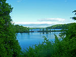
The Croton Falls Reservoir is a reservoir in the New York City water supply system in the Putnam County, New York townships of Carmel, and Southeast, roughly 50 miles (80 km) north of New York City. Part of the system's Croton Watershed, it was formed by impounding the West Branch and Middle Branch of the Croton River, tributaries of the Croton River, which flows into the Hudson River. Placed into service in 1911, the resulting reservoir has a drainage basin of 16 square miles (25.6 km²) and can hold 14.2 billion US gallons (54,000,000 m3) of water at full capacity. This includes all bodies of water that flow into the reservoir except for other reservoirs. Water sources in the basin include Michaels Brook, and Lake Gilead, one of three controlled lakes in the Croton Watershed. The reservoir is split into three portions by Putnam County Routes 35 and 38, which cross it with causeways and bridges. Water from the reservoir flows into Westchester County, New York, through the Muscoot Reservoir and New Croton Reservoir before entering the New Croton Aqueduct. Water in the Aqueduct flows through The Bronx into the Jerome Park Reservoir. In January 2007, the New York City Department of Environmental Protection reportedly began a $74 million project of improvements to the Croton Falls Reservoir and the Diverting Reservoir. The upgrading and rehabilitation is part of the city's effort to comply with state and federal dam safety regulations. At the Croton Falls Reservoir, the spillway - the structure that allows excess water to leave the reservoir - will be widened and deepened. The nearly 100-foot-tall (30 m) earthen and masonry dam will be resurfaced, a new bridge will be built over the redone spillway and various mechanical items, such as valves, will be replaced. In addition, cables anchoring the dam and spillway to the bedrock will be installed. The work will require the reservoir to be deepened 4 feet (1.2 m). The connecting channel between the two reservoirs will be emptied, inspected and dredged. Construction at both sites is expected to continue until Jan. 31, 2010.

Excerpt from the Wikipedia article Croton Falls Reservoir (License: CC BY-SA 3.0, Authors).

Croton Falls Reservoir
Stoneleigh Avenue,

Geographical coordinates (GPS) Address Nearby Places
placeShow on map

Wikipedia: Croton Falls ReservoirContinue reading on Wikipedia

Geographical coordinates (GPS)

Latitude Longitude
N 41.372 ° E -73.6693 °
placeShow on map

Address

Stoneleigh Avenue

Stoneleigh Avenue
10519
New York, United States
mapOpen on Google Maps

Share experience

Nearby Places

Diverting Reservoir

The Diverting Reservoir is a reservoir in the New York City water supply system in the town of Southeast, New York, in Putnam County immediately south of the village of Brewster, New York. Part of the system's Croton Watershed, it lies about 50 miles (80 km) north of New York City. Construction impounding the East Branch Croton River began early in the 20th century and was completed by 1911. The Diverting reservoir holds 900 million US gallons (3,400,000 m3) of water at full capacity, making it the smallest in New York City's water supply outside the City itself. Its drainage basin represents 8 square miles (21 km2) of the Croton River watershed. This basin includes the lakes, streams, rivers, and other bodies of water that flow into the reservoir. The Diverting Reservoir is also connected to the nearby Croton Falls Reservoir via a channel and dividing weir allowing water to freely pass between. The water in Diverting Reservoir flows into the continuation of the East Branch, which then joins the flow of the West Branch, itself carrying the flow of the Middle Branch, amid the headwaters of the Muscoot Reservoir, the collecting point for most of the Croton Watershed. It continues into the New Croton Reservoir, the final collecting point, then the New Croton Aqueduct. Water from the Aqueduct flows into the Jerome Park Reservoir. In January 2007, the New York City Department of Environmental Protection began a $74 million project of improvements to the Croton Falls Reservoir and the Diverting Reservoir. (See Journal-News article dated Feb. 28, 2007) The upgrading and rehabilitation is part of the city's effort to comply with state and federal dam safety regulations. The work at the Diverting Reservoir includes new valves and pipes, along with redoing the spillway and some of the concrete surfaces on the 55-foot (17 m)-high dam. The connecting channel between the two reservoirs will be emptied, inspected and dredged. Construction at both sites is expected to continue until Jan. 31, 2010.

Somers Hamlet Historic District

The Somers Hamlet Historic District is a historic district located along US 202 in Somers Hamlet in Westchester County, New York, United States. It is the stretch of highway between the junctions with NY 100 and NY 116, including small portions of both highways. Two side streets, Deans Bridge Road and The Lane, are also included, bringing its total area to 56 acres (22.4 ha).Forty-six of the 57 buildings, sites and structures within the district are considered contributing properties. Many of them date to the early 19th century, when the hamlet was at the junction of the Croton Turnpike (now NY 100) and the Peekskill-Danbury Turnpike (now US 202). Despite the increasing suburbanization and development in northern Westchester, particularly due to the nearby presence of the corporate headquarters of IBM and PepsiCo, the area has retained its historic integrity as a relic of the area's rural origins and a fine example of the migration of New England vernacular architectural styles into New York. The most significant contributing property, the Elephant Hotel at the junction of NY 100 and US 202, currently serves three functions. It is Somers' Town Hall, the offices of its historical society and the American Circus Historical Society. The latter agency reflects the building's historical importance as the birthplace of the circus in the United States. The brick Federal style structure, one of the finest examples of a hotel in that style in the state, was built by Hachaliah Bailey in 1825. A decade earlier he had brought an African elephant, Old Bet, to the U.S. Originally he had intended to use the animal in his fields, but he found he could make more money charging visitors to see Old Bet. He later organized a traveling menagerie that began to include other animal acts and human performers as well; this grew into what became part of the Ringling Bros. and Barnum & Bailey Circus.Other historic buildings in the area are primarily wood-frame structures built as dwellings, with barns and other outbuildings supporting businesses such as blacksmithies which did a thriving business on turnpike through traffic. The presence of two Shingle style houses on NY 116 near the district's eastern end signifies the time when suburbanization began in the late 19th century, as the homeowners were wealthy enough to afford to hire an architect rather than just use vernacular stylings. Two cemeteries are also included.The Elephant Hotel, first added to the National Register of Historic Places in 1974. The district was created and added to the Register thirty years later. The following year, 2005, the Elephant Hotel was designated a National Historic Landmark.