International District, Albuquerque, New Mexico

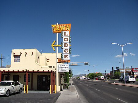
The International District is a neighborhood in southeast Albuquerque, New Mexico. It is centered on Central Avenue, the historic alignment of U.S. Route 66, and contains the New Mexico State Fairgrounds. The community is one of the most diverse areas of the city and is home to a large number of international restaurants and grocery stores, as well as the city's "Little Saigon" Vietnamese enclave. It is also one of the poorest areas in the city and has an extremely high violent crime rate. Although re-branded by city officials as the International District in 2009, Albuquerque residents continue to refer to the neighborhood by its longtime nickname, the "War Zone."
Excerpt from the Wikipedia article International District, Albuquerque, New Mexico (License: CC BY-SA 3.0, Authors, Images).International District, Albuquerque, New Mexico
Louisiana Boulevard Southeast, Albuquerque International District
Geographical coordinates (GPS) Address Phone number Website Nearby Places Show on map
Geographical coordinates (GPS)
| Latitude | Longitude |
|---|---|
| N 35.0725 ° | E -106.56833333333 ° |
Address
CareMore Chiropractic
Louisiana Boulevard Southeast 400
87106 Albuquerque, International District
New Mexico, United States
Open on Google Maps


