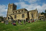
Blockley
AC with 0 elementsCotswold DistrictCotswoldsUse British English from March 2015Villages in Gloucestershire
Blockley is a village, civil parish and ecclesiastical parish in the Cotswold district of Gloucestershire, England, about 3 miles (5 km) northwest of Moreton-in-Marsh. Until 1931 Blockley was an exclave of Worcestershire. The civil and ecclesiastical parish boundaries are roughly coterminous, and include the hamlets of Draycott, Paxford and Aston Magna, the residential development at Northwick and the deserted hamlets of Upton and Upper Ditchford. Blockley village is on Blockley Brook, a tributary of Knee Brook. Knee Brook forms the northeastern boundary of the parish and is a tributary of the River Stour.
Excerpt from the Wikipedia article Blockley (License: CC BY-SA 3.0, Authors).Blockley
Bell Lane, Cotswold District Blockley
Geographical coordinates (GPS) Address Nearby Places Show on map
Geographical coordinates (GPS)
| Latitude | Longitude |
|---|---|
| N 52.0127 ° | E -1.7624 ° |
Address
Blockley Village Shop
Bell Lane
GL56 9ES Cotswold District, Blockley
England, United Kingdom
Open on Google Maps


