Côte de Trieu

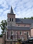
The Côte de Trieu (in French) or Knokteberg (in Dutch) is a hill in the municipality of Mont-de-l'Enclus, in the Belgian province of Hainaut. The road of the Côte de Trieu is on the south side of the Kluisberg, one of the hill formations in the Flemish Ardennes. The top of the hill, at 141 m above sea level, marks the border between Mont-de-l'Enclus and Kluisbergen, also the border between Wallonia and Flanders. The climb takes its French name after the hamlet of Trieu, at the southern foot of the hill. Trieu is part of the village of Russeignies, which, in turn, is part of the municipality of Mont-de-l'Enclus, in the north of the province of Hainaut. The climb starts with a gentle slope before gradually steepening to a maximum gradient of 13 % towards the top. With a length of 1,100 metres, it is one of the longer climbs of the region. The top of the hill is near the Flemish hamlet of Knokt, from which the climb takes its Dutch name.
Excerpt from the Wikipedia article Côte de Trieu (License: CC BY-SA 3.0, Authors, Images).Côte de Trieu
Knokstraat,
Geographical coordinates (GPS) Address Nearby Places Show on map
Geographical coordinates (GPS)
| Latitude | Longitude |
|---|---|
| N 50.765 ° | E 3.528 ° |
Address
Knokstraat 3
9690
East Flanders, Belgium
Open on Google Maps


