place

Chickering, Suffolk

Hamlets in SuffolkHoxneOpenDomesdaySuffolk geography stubsUse British English from March 2018
The driveway to Chickering Hall Farm geograph.org.uk 342837

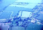
Chickering is a place in the civil parish of Hoxne, and the Mid Suffolk district of Suffolk, England. It is on the B118 Hoxne to Stradbroke road, and approximately 20 miles (30 km) north from the county town of Ipswich. Chickering is listed in the Domesday Book (1086) as 'Ciccheli (n) ga'/'Cikelinga'/'Citiringa'. The entry shows Chickering in the Bishop's Hundred of Suffolk, with 13 households, 4 freemen, 0.5 men's plough teams, a meadow of 2 acres (0.01 km2), and 20 pigs, with a tax revenue of 1.8 geld units. The freemen in 1066 were the lords of the manor, with their overlord being Edric of Laxfield. In 1086, after the Conquest, lordship was given to Walter son of Grip, under Robert Malet who was Tenant-in-chief to William the Conqueror.At Chickering is the seventeenth-century 'Chickering Hall' and farm; the hall is a Grade II listed building within Wingfield parish, with its farm partly extending into Hoxne. The water features at Chickering Hall have largely been filled in. In 1900 Chickering Hall and its farm, one of two farms, was trade directory listed in the parish of Hoxne. No other Chickering trades or occupations were listed at the time in Hoxne or Wingfield.

Excerpt from the Wikipedia article Chickering, Suffolk (License: CC BY-SA 3.0, Authors, Images).

Chickering, Suffolk
Chickering Road, Mid Suffolk

Geographical coordinates (GPS) Address Nearby Places
placeShow on map

Wikipedia: Chickering, SuffolkContinue reading on Wikipedia

Geographical coordinates (GPS)

Latitude Longitude
N 52.3396 ° E 1.2430644 °
placeShow on map

Address

Chickering Road

Chickering Road
IP21 5BT Mid Suffolk
England, United Kingdom
mapOpen on Google Maps

The driveway to Chickering Hall Farm geograph.org.uk 342837
Share experience

Nearby Places

Wingfield, Suffolk
Wingfield, Suffolk

Wingfield is a village in the English county of Suffolk. It is found 7 miles (11 km) east of Diss, signposted off B1118, near Eye. Wingfield Castle, which is now a private house, was for many centuries the home of the Wingfield family and their heirs, the De La Poles, Earls and Dukes of Suffolk. The Wingfields were a very ancient family and Sir John de Wingfield was chief of staff to the Black Prince. Sir John de Wingfield founded the great 14th-century church at Wingfield and his tomb can be found within it. Here visitors can see fine church monuments of Sir John de Wingfield and the De la Pole family. The church contains the effigy of Michael de la Pole Earl of Suffolk, and his wife Katherine. This Earl died of dysentery at the Siege of Harfleur whilst with Henry V on his Agincourt campaign of 1415.: 122  The Earl's son, also Michael, who was with his father, succeeded to the title but was killed a few weeks later whilst fighting under the King at the actual battle of Agincourt.: 254  The title then passed to the second son, William, who was aged fifteen at the time. William de la Pole, later first Duke of Suffolk, who was murdered after being exiled in 1450, was buried by his widow, Alice Chaucer, in the family church of the Charterhouse, Kingston upon Hull, as was his wish, and not in Wingfield church as is often stated. St Andrew's church contains fifteen 15th-century misericords. It is worth noting that they have more than a family resemblance to those at Sutton Courtenay now in Oxfordshire, but pre-1974 in Berkshire, and those at Soham in Cambridgeshire. The church's Tudor organ has been reconstructed and tours the country. It features in the film The Elusive English Organ.