place

Lower Bell

Pubs in KentReportedly haunted locations in South East England
Lower Bell Inn geograph.org.uk 1084059

The Lower Bell is a pub on the A229 Blue Bell Hill, between Chatham and Maidstone in Kent. It is located at the edge of the North Downs where the A229 meets the Pilgrims' Way.A pub has existed in the general area since around 1790, when the A229 was a turnpike road for coaches. The map maker and artist Paul Sandby painted A Distant View of Maidstone, from Lower Bell Inn, Boxley Hill in 1802, which depicts a view of the town from the pub. It is marked at its current location on a large-scale 1832 map of Kent. The current building was constructed in 1865.The purpose of the bell was for travellers to warn others further up the hill of their presence, as the road was too narrow for two teams of coach and horses to pass each other. There was a corresponding pub at the top of the hill called The Upper Bell, which would ring in response. The Upper Bell was demolished in 2013.The Lower Bell is cited as a location for a common ghost story, which originates from a fatal car accident involving a bride-to-be on the A229 outside the premises in November 1965. The typical story involves the apparition of a young woman attempting to hitch a lift outside the pub into the centre of Maidstone or another local village, who subsequently vanishes en route. A local journalist attempted to verify the story for the Maidstone Gazette in 1968, but was unable to find any suitable eyewitnesses after months of research. In 2015, on the fiftieth anniversary of the accident, a paranormal enthusiasts' group met in the Lower Bell to discuss the various ghost stories. A short film, entitled The Ghost of Blue Bell Hill, was shot around the premises.Live music is a regular feature at the Lower Bell. The pub runs a jam session every Monday.

Excerpt from the Wikipedia article Lower Bell (License: CC BY-SA 3.0, Authors, Images).

Lower Bell
Rochester Road, Tonbridge and Malling Aylesford

Geographical coordinates (GPS) Address Nearby Places
placeShow on map

Wikipedia: Lower BellContinue reading on Wikipedia

Geographical coordinates (GPS)

Latitude Longitude
N 51.318055555556 ° E 0.50777777777778 °
placeShow on map

Address

Rochester Road
ME20 7EF Tonbridge and Malling, Aylesford
England, United Kingdom
mapOpen on Google Maps

Lower Bell Inn geograph.org.uk 1084059
Share experience

Nearby Places

Kit's Coty House
Kit's Coty House

Kit's Coty House or Kit's Coty is a chambered long barrow near the village of Aylesford in the southeastern English county of Kent. Constructed circa 4000 BCE, during the Early Neolithic period of British prehistory, today it survives in a ruined state. Archaeologists have established that the monument was built by pastoralist communities shortly after the introduction of agriculture to Britain from continental Europe. Although representing part of an architectural tradition of long barrow building that was widespread across Neolithic Europe, Kit's Coty House belongs to a localised regional variant of barrows produced in the vicinity of the River Medway, now known as the Medway Megaliths. Of these, it lies near to both Little Kit's Coty House and the Coffin Stone on the eastern side of the river. Three further surviving long barrows, Addington Long Barrow, Chestnuts Long Barrow, and Coldrum Long Barrow, are located west of the Medway. They were among the first ancient British remains to be protected by the state, on the advice of General Augustus Pitt-Rivers, the first Inspector of Ancient Monuments. The site is now under the ownership of non-departmental public body English Heritage, and is open to visitors all year round.Kit's Coty can be reached on foot along a track that appears at the junction where the Pilgrim's Way and Rochester Road meet. The chamber is encircled by iron railings. It lies approximately 2 kilometres north of another of the Medway Megaliths, Little Kit's Coty House.The name "Kits Coty" allegedly means "Tomb in the Forest" according to signs at the site, possibly related to the Ancient British *kaitom, later *keiton, meaning "forest". The site is the namesake of Kitscoty, a village in Alberta, Canada. The inclusion of the term "House" in the site's name has confused some visitors, who have gone to the site expecting a built dwelling.

Little Kit's Coty House

Little Kit's Coty House, also known as Lower Kit's Coty House and the Countless Stones, is a chambered long barrow located near to the village of Aylesford in the southeastern English county of Kent. Constructed circa 4000 BCE, during the Early Neolithic period of British prehistory, today it survives in a ruined state. Archaeologists have established that the monument was built by pastoralist communities shortly after the introduction of agriculture to Britain from continental Europe. Although representing part of an architectural tradition of long barrow building that was widespread across Neolithic Europe, Kit's Coty House belongs to a localised regional variant of barrows produced in the vicinity of the River Medway, now known as the Medway Megaliths. Of these, it lies near to both Kit's Coty House and the Coffin Stone on the eastern side of the river. Three further surviving long barrows, Addington Long Barrow, Chestnuts Long Barrow, and Coldrum Long Barrow, are located west of the Medway. Now a jumble of half-buried sarsen stones it is thought to have been a tomb similar to that of the Coldrum Stones. The name is derived from the belief that the chaotic pile of stones from the collapsed tomb were uncountable and various stories are told about the fate of those who tried. Another nearby site that may have been Neolithic is at Cossington. There are between 19 and 21 stones depending on the authority. They were pushed over in the seventeenth century seemingly before any antiquarian interest was taken in them. William Stukeley attempted to reconstruct the damaged tomb in plan in the eighteenth century. Archaeological evaluation trenching in 1989 found no clear evidence of any surrounding quarry ditch which would normally have been excavated to provide material for a covering barrow.

White Horse Stone
White Horse Stone

The White Horse Stone is a name given to two separate sarsen megaliths east of Blue Bell Hill, near the hamlet of Sandling and the village of Aylesford, north of Maidstone, in the south-eastern English county of Kent. The Lower White Horse Stone was destroyed prior to 1834, at which time the surviving Upper White Horse Stone took on its name and folkloric associations. Various archaeologists have suggested—although not proven—that the stones were each part of chambered long barrows constructed in the fourth millennium BC, during Britain's Early Neolithic period. If the White Horse Stones were originally components of chambered long barrows, then they would have been erected by pastoralist communities shortly after the introduction of agriculture to Britain from continental Europe. Long-barrow building was an architectural tradition widespread across Neolithic Europe although comprised various localised regional variants; one of these was in the vicinity of the River Medway, examples of which are now known as the Medway Megaliths. The White Horse Stones lie on the eastern side of the river, along with the chambered long barrows of Little Kit's Coty House, Kit's Coty House, the (now destroyed) Smythe's Megalith, and the Coffin Stone, which may be a part of a fourth. Three other examples, the Coldrum Long Barrow, Addington Long Barrow, and Chestnuts Long Barrow, remain on the western side of the river. Excavation has revealed the existence of an Early Neolithic longhouse near to the stone. By the 19th century, antiquarians were speculating that the Lower White Horse Stone may have taken its name from the White Horse of Kent, which they in turn believed was the flag of the legendary fifth-century Anglo-Saxon warriors Hengest and Horsa. Subsequent historical research has not accepted this interpretation. After the stone was destroyed, the stories associated with it were transposed to a nearby sarsen boulder, which became known as the Upper White Horse Stone. Since at least the 1980s, the latter has been viewed as a sacred site by various Folkish Heathen groups, including the Odinic Rite, because of its folkloric associations with Hengest and Horsa and the Anglo-Saxon Migration. As well as performing rituals there, they have opposed vandalism of the stone and campaigned to stop development in the vicinity.

Medway Megaliths
Medway Megaliths

The Medway Megaliths, sometimes termed the Kentish Megaliths, are a group of Early Neolithic chambered long barrows and other megalithic monuments located in the lower valley of the River Medway in Kent, South-East England. Constructed from local sarsen stone and soil between the 4th and 3rd millennia BCE, they represent the only known prehistoric megalithic group in eastern England and the most south-easterly group in Britain. They remain one of several regionally contained chambered long barrow traditions in Britain, although have certain precise architectural characteristics which mark them out as distinct from other groups. The purpose of these long barrows remains elusive, although some were used as tombs for the remains of a select group of individuals. It is also widely believed that they were places where religious rituals were performed. Many archaeologists believe that they reflect the process of Neolithisation of Britain, as hunter-gatherer populations were replaced by pastoralists. Three chambered tombs have been identified to the west of the river: the Coldrum Stones, Addington Long Barrow, and Chestnuts Long Barrow. To the east of the river, another three chambered tombs have been identified: Kit's Coty House, Little Kit's Coty House, and Smythe's Megalith, although it has also been suggested that two nearby megaliths, the Coffin Stone and the White Horse Stone, are remnants of former chambered tombs. An Early Neolithic longhouse and causewayed enclosure have also been identified in the vicinity of the monuments. The Medway Megaliths have become heavily damaged and dilapidated since original construction, largely due to an intentional program of destruction in the late 13th century CE. They began to attract the interest of antiquarians in the late 16th century, who developed a number of erroneous theories about their origin, before later being scientifically investigated by archaeologists in the late 19th century. Local folklore has also grown up around the monuments, which came to be interpreted and used as sacred sites by contemporary Pagans in the latter 20th century.

Smythe's Megalith
Smythe's Megalith

Smythe's Megalith, also known as the Warren Farm Chamber, was a chambered long barrow east of Blue Bell Hill, north of Maidstone, in the south-eastern English county of Kent, close to Aylesford village and the hamlet of Sandling. Probably constructed in the 4th millennium BCE, during Britain's Early Neolithic period, it was discovered in 1822, at which point it was dismantled. Built out of earth and at least five local sarsen megaliths, the long barrow consisted of a roughly rectangular earthen tumulus with a stone chamber in its eastern end. Human remains were deposited into this chamber. Archaeologists have established that the monument was built by pastoralist communities shortly after the introduction of agriculture to Britain from continental Europe. Although representing part of an architectural tradition of long barrow building widespread across Neolithic Europe, Smythe's Megalith belonged to a localised regional variant produced in the vicinity of the River Medway, now known as the Medway Megaliths. Several of the Medway Megaliths still survive: Coldrum Long Barrow, Addington Long Barrow, and Chestnuts Long Barrow are on the river's western side, while Kit's Coty House, the Little Kit's Coty House, and the Coffin Stone are on the eastern side nearer to Smythe's Megalith. Close to the site of the lost monument is the White Horse Stone, a standing stone that may have once been part of another chambered long barrow. The site may have been ransacked during the Middle Ages, as other Medway Megaliths were. By the early 19th century it was buried beneath soil, largely due to millennia of hillwash coming down from the adjacent Blue Bell Hill. In 1822, it was discovered by farm labourers ploughing the land; the local antiquarians Clement Smythe and Thomas Charles were called in to examine it. Shortly after, the labourers pulled away the stones and dispersed most of the human remains, destroying the monument. Smythe and Charles produced, but did not publish, reports on their findings, and these have been discussed by archaeologists since the mid-20th century.

Coffin Stone
Coffin Stone

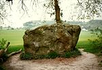
The Coffin Stone, also known as the Coffin and the Table Stone, is a large sarsen stone at the foot of Blue Bell Hill near Aylesford in the south-eastern English county of Kent. Now lying horizontally, the stone probably once stood upright nearby. Various archaeologists have argued that the stone was part of a now-destroyed chambered long barrow constructed in the fourth millennium BCE, during Britain's Early Neolithic period. If a chambered long barrow did indeed previously exist on the site, it would have been built by pastoralist communities shortly after the introduction of agriculture to Britain from continental Europe. Long-barrow building was an architectural tradition widespread across Neolithic Europe. It consisted of various localized regional variants; one of these was in the vicinity of the River Medway, examples of which are now known as the Medway Megaliths. The Coffin Stone lies on the eastern side of the river, not far from the chambered long barrows of Little Kit's Coty House, Kit's Coty House, and the (now destroyed) Smythe's Megalith. Three other examples, the Coldrum Long Barrow, Addington Long Barrow, and Chestnuts Long Barrow, remain on the western side of the river. The Coffin Stone is a rectangular slab lying flat that measures 4.42 metres (14 ft 6 in) in length, 2.59 metres (8 ft 6 in) in breadth, and about 0.61 metres (2 ft) in width. Two smaller stones lie nearby and another large slab is now located atop it. In the 1830s it was reported that local farmers found human bones near the stone. An archaeological excavation of the site led by Paul Garwood took place in 2008–09; it found that the megalith was placed in its present location only in the 15th or 16th centuries. The archaeologists found no evidence of a chambered long barrow at the location, and suggested that the Coffin Stone might once have stood upright in the vicinity.