place

Lake Mead National Recreation Area

1936 establishments in Arizona1936 establishments in NevadaIUCN Category VLake MeadLake Mead National Recreation Area
National Park Service National Recreation AreasNational Park Service areas in ArizonaNational Park Service areas in NevadaProtected areas established in 1936Protected areas of Clark County, NevadaProtected areas of Mohave County, ArizonaProtected areas of the Mojave DesertProtected areas on the Colorado River
Cottonwood Cove on Lake Mohave at Lake Mead NRA

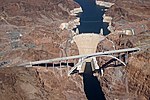
Lake Mead National Recreation Area is a U.S. national recreation area in southeastern Nevada and northwestern Arizona. Operated by the National Park Service, Lake Mead NRA follows the Colorado River corridor from the westernmost boundary of Grand Canyon National Park to just north of the cities of Laughlin, Nevada and Bullhead City, Arizona. It includes all of the eponymous Lake Mead as well as the smaller Lake Mohave – reservoirs on the river created by Hoover Dam and Davis Dam, respectively – and the surrounding desert terrain and wilderness.Formation of Lake Mead began in 1935, less than a year before Hoover Dam was completed. The area surrounding Lake Mead was protected a bird refuge in 1933, later established as the Boulder Dam Recreation Area in 1936 and the name was changed to Lake Mead National Recreation Area in 1947. In 1964, the area was expanded to include Lake Mohave and its surrounding area and became the first National Recreation Area to be designated as such by the U.S. Congress.

Excerpt from the Wikipedia article Lake Mead National Recreation Area (License: CC BY-SA 3.0, Authors, Images).

Lake Mead National Recreation Area
Lakeshore Road,

Geographical coordinates (GPS) Address Nearby Places
placeShow on map

Wikipedia: Lake Mead National Recreation AreaContinue reading on Wikipedia

Geographical coordinates (GPS)

Latitude Longitude
N 36.009722222222 ° E -114.79666666667 °
placeShow on map

Address

Lake Mead Visitor Center

Lakeshore Road

Nevada, United States
mapOpen on Google Maps

Cottonwood Cove on Lake Mohave at Lake Mead NRA
Share experience

Nearby Places

Mike O'Callaghan–Pat Tillman Memorial Bridge

The Mike O'Callaghan–Pat Tillman Memorial Bridge is an arch bridge in the United States that spans the Colorado River between the states of Arizona and Nevada. The bridge is located within the Lake Mead National Recreation Area approximately 30 miles (48 km) southeast of Las Vegas, and carries Interstate 11 and U.S. Route 93 over the Colorado River. Opened in 2010, it was the key component of the Hoover Dam Bypass project, which rerouted US 93 from its previous routing along the top of Hoover Dam and removed several hairpin turns and blind curves from the route. It is jointly named for Mike O'Callaghan, Governor of Nevada from 1971 to 1979, and Pat Tillman, an American football player who left his career with the Arizona Cardinals to enlist in the United States Army and was killed in Afghanistan in 2004 by friendly fire. As early as the 1960s, officials identified the US 93 route over Hoover Dam to be dangerous and inadequate for projected traffic volumes. From 1998 to 2001, officials from Arizona, Nevada, and several federal government agencies collaborated to determine the best routing for an alternative river crossing. In March 2001, the Federal Highway Administration selected the route, which crosses the Colorado River approximately 1,500 feet (460 m) downstream of Hoover Dam. Construction of the bridge approaches began in 2003, and construction of the bridge itself began in February 2005. The bridge was completed in 2010 and the entire bypass route opened to vehicle traffic on October 19, 2010. The Hoover Dam Bypass project was completed within budget at a cost of $240 million; the bridge portion cost $114 million.The bridge was the first concrete-steel composite deck arch bridge built in the United States, and incorporates the widest concrete arch in the Western Hemisphere. At 890 feet (270 m) above the Colorado River, it is the second highest bridge in the United States after the Royal Gorge Bridge near Cañon City, Colorado, and is the world's highest concrete arch bridge.