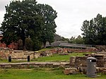
Aker, Norway
Aker was a former independent municipality in Akershus, Norway, that constitutes the vast majority of the territory of the modern city of Oslo. The name originally belonged to a farm which was located near the current Old Aker Church. The church in turn became the source of the name of the parish and later municipality as well as Akershus Fortress, the main fief and main county of Akershus which included most of Eastern Norway until 1919, the smaller county of Akershus, and numerous institutions within this area. Aker municipality was in terms of population by far the largest municipality of Akershus county and surrounded the capital city of Christiania (renamed Oslo in 1925) until 1948; Aker was 27 times larger than the capital it surrounded. In the late 19th century Aker ceded some of its territory to Christiania, and in 1948 Aker merged completely with Oslo municipality to create the modern, vastly enlarged Oslo municipality. The merger was unpopular in Aker, which at the time was an affluent suburban community. The Aker name remains in use in two districts of Oslo, Vestre Aker and Nordre Aker, which are only a small part of former Aker municipality.
Excerpt from the Wikipedia article Aker, Norway (License: CC BY-SA 3.0, Authors).Aker, Norway
Kong Håkon 5.s gate, Oslo Gamle Oslo
Geographical coordinates (GPS) Address Nearby Places Show on map
Geographical coordinates (GPS)
| Latitude | Longitude |
|---|---|
| N 59.905466666667 ° | E 10.759736111111 ° |
Address
Clemenskvartalet
Kong Håkon 5.s gate
0191 Oslo, Gamle Oslo
Norway
Open on Google Maps


