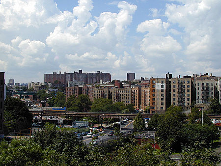
Morris Heights, Bronx
Morris Heights, BronxNeighborhoods in the BronxUse mdy dates from August 2018

Morris Heights is a residential neighborhood located in the West Bronx. Its boundaries, starting from the north and moving clockwise are: West Burnside Avenue to the north, Jerome Avenue to the east, the Cross-Bronx Expressway to the south, and the Harlem River to the west. University Avenue is the primary thoroughfare through Morris Heights. The neighborhood is part of Bronx Community Board 5, and its ZIP Codes include 10453 and 10452. The area is patrolled by the New York City Police Department's 46th Precinct. New York City Housing Authority (NYCHA) property in the area is patrolled by P.S.A. 7 at 737 Melrose Avenue in the Melrose section of the Bronx.
Excerpt from the Wikipedia article Morris Heights, Bronx (License: CC BY-SA 3.0, Authors, Images).Morris Heights, Bronx
Popham Avenue, New York The Bronx
Geographical coordinates (GPS) Address Nearby Places Show on map
Geographical coordinates (GPS)
| Latitude | Longitude |
|---|---|
| N 40.85 ° | E -73.92 ° |
Address
Popham Avenue 1706
10453 New York, The Bronx
New York, United States
Open on Google Maps


