place

Wilson Avenue station

Accessible New York City Subway stationsBMT Canarsie Line stationsBushwick, BrooklynNational Register of Historic Places in BrooklynNew York City Subway stations in Brooklyn
New York City Subway stations located abovegroundNew York City Subway stations located at-gradeRailway and subway stations on the National Register of Historic Places in New York CityRailway stations in the United States opened in 1928Use mdy dates from August 2017
Wilson Av upper platform vc

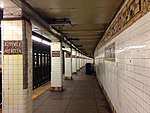
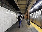
The Wilson Avenue station is a station on the BMT Canarsie Line of the New York City Subway. Located at the intersection of Wilson Avenue and Moffat Street in Brooklyn, it is served by the L train at all times.

Excerpt from the Wikipedia article Wilson Avenue station (License: CC BY-SA 3.0, Authors, Images).

Wilson Avenue station
Wilson Avenue, New York Brooklyn

Geographical coordinates (GPS) Address External links Nearby Places
placeShow on map

Wikipedia: Wilson Avenue stationContinue reading on Wikipedia

Geographical coordinates (GPS)

Latitude Longitude
N 40.6885 ° E -73.9044 °
placeShow on map

Address

Wilson Avenue

Wilson Avenue
11207 New York, Brooklyn
New York, United States
mapOpen on Google Maps

linkWikiData (Q2616774)
linkOpenStreetMap (597937433)

Wilson Av upper platform vc
Share experience

Nearby Places

Ridgewood Park (baseball ground)

Ridgewood Park, also known as Wallace's Ridgewood Park or the Wallace Grounds, and frequently confused with Grauer's Ridgewood Park, was a baseball ground in Ridgewood, Queens, New York. Both Wallace's and Grauer's are shown in Belcher Hyde's Map of Newtown in 1915. The baseball field was part of a larger entertainment area bounded Wyckoff Avenue, Covert Street, Halsey Street, and Irving Avenue. (Halsey Street also bordered the old Capitoline Grounds about 2 miles (3.2 km) west.) The baseball field was southwest of the Long Island Rail Road's Montauk Branch tracks. Eldert Street, although depicted on the map as running through the baseball grounds, was not cut through southwest of the railroad tracks and the road remains interrupted there today. Originally the park was in Queens County, before its incorporation into New York City in 1899. This facilitated Sunday baseball playing, including the charging of admission, beyond the reach of Sabbath enforcers from the then-city of Brooklyn. Grauer's Ridgewood Park or Grauer's Woods was a large parkland several blocks north of Wallace's ballpark, bounded by Myrtle Avenue, Cypress Avenue, Seneca Avenue, and Decatur Street. Although some baseball was played here, this area was more of a picnic park. George Schubel in 1913 lyrically describes the pleasures of Grauer's Ridgewood Park: "Here the German families of another generation assembled and enjoyed themselves in innocent recreation very much in the manner that they were accustomed to do across the seas. Most of these parks have been eliminated, owing to the increase in land values and the decline of this sort of amusement." He also notes that "This once beautiful park is now cut up with such streets as Centre Street, George Street, Norman Street, Summerfield Street, and Willow Street, running through the land."The land that would become Wallace's Ridgewood Park was purchased by William Wallace in 1884. On April 5, 1885, the first game was played between the Brooklyn Atlantics and the Ridgewoods before a reported 3,000 fans. According to Retrosheet, Ridgewood Park was used by the Brooklyn Trolley Dodgers from 1887-1889 after they had played some games in the 1886 season at Grauer's. The Dodgers had used it strictly for Sunday games, to get around Brooklyn's blue laws. The Brooklyn Gladiators played their full 1890 schedule at Wallace's. The field was home to the semipro Ridgewoods; later the Brooklyn Bushwicks and the Negro league Brooklyn Royal Giants also played there. On September 19, 1917, the grandstand burned, precipitating the Bushwicks' move to Dexter Park in 1918. Wallace apparently intended to subdivide the land put it up for sale in that year, but ultimately he would rebuild, and the property was not sold until 1927. Although it was gradually reduced in size, the park survived and hosted soccer and other sports as Grand Stadium until 1959, when it was replaced by industrial buildings.Grand Stadium once again played host to the Dodgers as a training site in its waning years. The Eagle reported on February 26, 1947, that Branch Rickey "looked refreshed on his arrival at Grand Stadium to watch the 20 who had been tempted [by Mexican promoter Pasquel's contract offers] and 30 other Dodgers go through their long drill." Although this passing reference does not conclusively establish the connection, it seems that the Dodgers returned briefly to their old stomping grounds some 60 years later.Yet another Ridgewood ballpark was Meyerrose Park, which existed from 1907 through 1911. It was the home of an "outlaw" Brooklyn club for two seasons, in the Atlantic League (1907) and Union League (1908). It was on part of the former Meyerrose Farm, a large block bounded by Myrtle Avenue, Gates Avenue, Covert (now Seneca) Avenue, and Woodward Avenue. After the 1911 season, it was sold to developers, and Onderdonk Avenue was cut through.[1]

Broadway Junction station

The Broadway Junction station is a New York City Subway station complex shared by the elevated BMT Canarsie Line and BMT Jamaica Line, and the underground IND Fulton Street Line. It was also served by trains of the Fulton Street Elevated until that line closed in 1956. It is located roughly at the intersection of Broadway, Fulton Street and Van Sinderen Avenue at the border of Bedford–Stuyvesant and East New York, Brooklyn. The complex is served by the A, J, and L trains at all times; the C train at all times except late nights; and the Z train during rush hours in the peak direction only. The station is adjacent to the East New York Yard and a complex track junction between the tracks leading to the yard, the Canarsie Line, and the Jamaica Line. The structure of the elevated station still contains the ironwork for the trackways used by the old Fulton Elevated. The station has a single exit and entrance through a fare control building located at the eastern end of the Fulton Street Line station. There is evidence of closed exits from the Jamaica Line platforms. The station opened as Manhattan Junction as part of the BMT Lexington Avenue Line in 1885. In 1900, an elevated connection was made with the Fulton Street Elevated, resulting in a change in service patterns. Lexington Avenue and Fulton Street trains were through-routing, going around the East New York Loop, with service to Cypress Hills requiring a transfer. The station started to be used by service to Canarsie in 1906. In 1919, the Manhattan Junction station was replaced by the current station which was then known as Eastern Parkway. The modern-day Canarsie Line platforms, known as Broadway Junction, opened in 1928 when that line was connected to the 14th Street–Eastern District Line. The Independent Subway System's Fulton Street Line was extended to Broadway–East New York in 1946, and the three stations were combined as one station complex on July 1, 1948. The names of the stations in the complex were conformed to Broadway Junction in 2003. Although Broadway Junction ranked 166th in the system for passenger entries in 2016, with 3,085,401 total entries, it is Brooklyn's third-busiest station in terms of passenger activity. It sees 100,000 passengers per day as of 2017, the vast majority of whom use it to make transfers. In 2017, the New York City Economic Development Corporation started studying options to rezone the surrounding area as a transit hub.