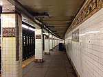
The Broadway Junction station is a New York City Subway station complex shared by the elevated BMT Canarsie Line and BMT Jamaica Line, and the underground IND Fulton Street Line. It was also served by trains of the Fulton Street Elevated until that line closed in 1956. It is located roughly at the intersection of Broadway, Fulton Street and Van Sinderen Avenue at the border of Bedford–Stuyvesant and East New York, Brooklyn. The complex is served by the A, J, and L trains at all times; the C train at all times except late nights; and the Z train during rush hours in the peak direction only.
The station is adjacent to the East New York Yard and a complex track junction between the tracks leading to the yard, the Canarsie Line, and the Jamaica Line. The structure of the elevated station still contains the ironwork for the trackways used by the old Fulton Elevated. The station has a single exit and entrance through a fare control building located at the eastern end of the Fulton Street Line station. There is evidence of closed exits from the Jamaica Line platforms.
The station opened as Manhattan Junction as part of the BMT Lexington Avenue Line in 1885. In 1900, an elevated connection was made with the Fulton Street Elevated, resulting in a change in service patterns. Lexington Avenue and Fulton Street trains were through-routing, going around the East New York Loop, with service to Cypress Hills requiring a transfer. The station started to be used by service to Canarsie in 1906. In 1919, the Manhattan Junction station was replaced by the current station which was then known as Eastern Parkway. The modern-day Canarsie Line platforms, known as Broadway Junction, opened in 1928 when that line was connected to the 14th Street–Eastern District Line. The Independent Subway System's Fulton Street Line was extended to Broadway–East New York in 1946, and the three stations were combined as one station complex on July 1, 1948. The names of the stations in the complex were conformed to Broadway Junction in 2003.
Although Broadway Junction ranked 166th in the system for passenger entries in 2016, with 3,085,401 total entries, it is Brooklyn's third-busiest station in terms of passenger activity. It sees 100,000 passengers per day as of 2017, the vast majority of whom use it to make transfers. In 2017, the New York City Economic Development Corporation started studying options to rezone the surrounding area as a transit hub.


