place

East Broadway station

1936 establishments in New York CityChinatown, ManhattanFuture accessible New York City Subway stationsIND Sixth Avenue Line stationsLower East Side
New York City Subway stations in ManhattanNew York City Subway stations located undergroundRailway stations in the United States opened in 1936Use mdy dates from January 2017
IND Sixth East Broadway

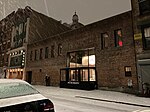
The East Broadway station is a station on the IND Sixth Avenue Line of the New York City Subway. Located at East Broadway and Rutgers Street in the Lower East Side, it is served by the F train at all times and the train during rush hours in the peak direction. The East Broadway station was built for the Independent Subway System (IND)'s Sixth Avenue Line and opened on January 1, 1936. It contains one island platform and two tracks. The station was initially intended as an interchange station with the Worth Street Line underneath East Broadway, to be built as part of the IND Second System, although the other line was not completed. As a result, the station contains several mezzanines, one of which was originally intended as the platform level of the Worth Street Line. The station has exits to Rutgers Street's intersections with East Broadway and with Madison Street.

Excerpt from the Wikipedia article East Broadway station (License: CC BY-SA 3.0, Authors, Images).

East Broadway station
East Broadway, New York Manhattan

Geographical coordinates (GPS) Address Nearby Places
placeShow on map

Wikipedia: East Broadway stationContinue reading on Wikipedia

Geographical coordinates (GPS)

Latitude Longitude
N 40.714216 ° E -73.990259 °
placeShow on map

Address

East Broadway

East Broadway
10002 New York, Manhattan
New York, United States
mapOpen on Google Maps

IND Sixth East Broadway
Share experience

Nearby Places

Henry Street (Manhattan)

Henry Street is a street in the Lower East Side of the New York City borough of Manhattan that runs one-way eastbound, except for two small two-way segments west of Pike Street and east of Montgomery Street. It spans from Oliver Street in the west (locally called "south" because it is towards downtown), passing underneath the Manhattan Bridge and on to Grand Street in the east ("north"). The street is named for Henry Rutgers, a hero of the American Revolutionary War and prominent philanthropist. Rutgers Street, which intersects with Henry Street, is also named for him.Thanks to Rutgers' generosity a church was constructed at Henry and Oliver Streets to serve sailors from the East River docks. The Mariner's Temple at 3 Henry Street was built in 1845, and continued to serve maritime workers and their families. It is a New York City Landmark, and was added to the National Register of Historic Places in 1980. The poor condition of immigrants living in squalid tenements on Henry Street and the surrounding neighborhood in the late 19th century prompted nurses Lillian Wald and Mary Maud Brewster to found the Henry Street Settlement in 1893. In recent times, Henry Street continues to be an immigrant neighborhood and has been absorbed into an expanding Chinatown.St. Augustine's Church at 290 Henry Street between Montgomery and Grand Streets was built in 1827–29 as the All Saints' Free Church, and was constructed out of Manhattan schist. The Georgian-Gothic design is credited to architect John Heath. It was designated a New York City landmark in 1966.At the northwest corner of (16–18) Rutgers Street, Henry Street fronts The Roman Catholic Church of St. Theresa, built 1841 for the First Presbyterian Church of New York (PCUSA). In recognition of Henry Street's multicultural history, the Henry Street School for International Studies opened in 2004 at 220 Henry Street. The Henry Street School lower school (grades 6–8) welcomes a diverse group of students from the Bronx, Manhattan, Brooklyn and Queens. The school is one of the New York City Department of Education's small schools and is supported by the Asia Society and the Bill and Melinda Gates Foundation.

Dimes Square

Dimes Square is a so-called "microneighborhood" of New York City, located between the Chinatown and Lower East Side neighborhoods of Manhattan. The exact perimeter and nature of the neighborhood is debated, though survey data from The New York Times lists it as roughly the five blocks on either side of Canal Street between Allen Street and Essex Street. The neighborhood's name, a play on "Times Square", refers to Dimes, a restaurant located at the intersection of Canal Street and Division Street on the Lower East Side. According to Marisa Meltzer of The New York Times, the nickname has transitioned from a term used "jokingly" to one used "semi-seriously". The term Dimes Square has become a metonym for a number of associated reactionary aesthetic movements centered in the area. Media associated with the area include the podcast Red Scare, pirate radio station Montez Press Radio, and defunct print newspaper The Drunken Canal. An online Dimes zine named Byline was established in 2023 by Gutes Guterman and Megan O'Sullivan. Ben Smith cited the neighborhood's emergence as a lockdown-flouting cultural hub during the COVID-19 pandemic in a 2021 New York Times piece. As the Covid-19 restrictions receded and the neighborhood became more mainstream, the associated transgressive art movement digitized and became increasingly prominent in online culture. In 2022, Julia Yost, an editor at First Things, a conservative religious journal, argued in an op-ed in The New York Times that the neighborhood and associated podcasters such as Dasha Nekrasova of Red Scare are the center of a post-ironic revival of traditionalist Catholicism. The American indie-pop band Bleachers reference Dimes Square in their 2024 song "Jesus is Dead" from their self-titled album Bleachers. In 2020, two blocks of Canal Street were closed off for an Open Streets permit, resulting in what Hannah Goldfield of The New Yorker describes as a "circus", "every night a music festival in the piazza."