place

Oceanport Draw

1914 establishments in New JerseyBridges completed in 1914Bridges in Monmouth County, New JerseyCentral Railroad of New JerseyNJ Transit bridges
Oceanport, New JerseyPennsylvania Railroad bridgesRailroad bridges in New JerseySwing bridges in the United StatesUse mdy dates from November 2020

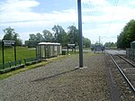
Oceanport Draw is railroad moveable bridge over the Oceanport Creek (MP 8.4), a tributary of the Shrewsbury River, in Oceanport in Monmouth County, New Jersey, United States. It is owned and operated by New Jersey Transit Rail Operations (NJT).

Excerpt from the Wikipedia article Oceanport Draw (License: CC BY-SA 3.0, Authors).

Oceanport Draw
Leeward Court,

Geographical coordinates (GPS) Address Nearby Places
placeShow on map

Wikipedia: Oceanport DrawContinue reading on Wikipedia

Geographical coordinates (GPS)

Latitude Longitude
N 40.3183 ° E -74.02527 °
placeShow on map

Address

Leeward Court

Leeward Court
07757 , Port-au-Peck
New Jersey, United States
mapOpen on Google Maps

Share experience

Nearby Places

Shore Regional High School

Shore Regional High School is a regional public high school and school district serving students from four communities in Monmouth County, New Jersey, United States. The high school serves students from the constituent municipalities of Monmouth Beach, Oceanport, Sea Bright and West Long Branch, where the school is located.Students from Interlaken attend public school in the West Long Branch Public Schools for K-8 and Shore Regional High School for grades 9–12, as part of sending/receiving relationships with the districts in which students attend on a tuition basis, having ended a longstanding relationship with the Asbury Park Public Schools, as do students from Loch Arbour, New Jersey, who began attending schools in West Long Branch for K-8 and Shore Regional for 9–12 starting in the 2017–18 school year, after leaving the Ocean Township School District. Students from Deal attended the Deal School District for K-8 and then attend Shore Regional following the termination of its previous agreement with Asbury Park.Shore Regional High School has been an IB World School since April 2007, offering students the IB Diploma Programme. The school has been accredited by the Middle States Association of Colleges and Schools Commission on Elementary and Secondary Schools since 1969; The school's accreditation status was extended for seven years in Fall 2018.As of the 2020–21 school year, the school had an enrollment of 609 students and 54.1 classroom teachers (on an FTE basis), for a student–teacher ratio of 11.3:1. There were 24 students (3.9% of enrollment) eligible for free lunch and 7 (1.1% of students) eligible for reduced-cost lunch.The district is classified by the New Jersey Department of Education as being in District Factor Group "FG", the fourth-highest of eight groupings. District Factor Groups organize districts statewide to allow comparison by common socioeconomic characteristics of the local districts. From lowest socioeconomic status to highest, the categories are A, B, CD, DE, FG, GH, I and J.

Fort Monmouth
Fort Monmouth

Fort Monmouth is a former installation of the Department of the Army in Monmouth County, New Jersey. The post is surrounded by the communities of Eatontown, Tinton Falls and Oceanport, New Jersey, and is located about five miles (8.0 km) from the Atlantic Ocean. The post covers nearly 1,126 acres (4.56 km2) of land, from the Shrewsbury River on the east, to Route 35 on the west; this area is referred to as 'Main Post'. A separate area (Camp Charles Wood) to the west includes post housing, a golf course, and additional office and laboratory facilities. A rail line, owned by Conrail, runs through Camp Charles Wood and out to Naval Weapons Station Earle. The post is like a small town, including a Post Exchange (PX), health clinic, gas station and other amenities. Until the September 11, 2001 terrorist attacks the post was open to the public to drive through; after that time, the post was closed to all but authorized personnel. The main road through the fort was reopened to the public in 2017. The post was home to several units of the U.S. Army Materiel Command and offices of the Army Acquisition Executive (AAE) that research and manage Command and Control, Communications, Computing, Intelligence, Surveillance and Reconnaissance (C4ISR) capabilities and related technology, as well as an interservice organization designed to coordinate C4ISR, an academic preparatory school, an explosive ordnance disposal (EOD) unit, a garrison services unit, an Army health clinic, and a Veterans Administration health clinic. Other agencies, including the Federal Bureau of Investigation, Federal Emergency Management Agency and the National Security Agency, have presences on the post. The post was selected for closure by the Base Realignment and Closure Commission in 2005. Most Army functions and personnel were required to be moved to Army facilities in Maryland—such as Aberdeen Proving Ground—and Ohio by 2011. The post officially closed on September 15, 2011. However, it was temporarily reopened on December 2, 2012, for the evacuation of the borough of Paulsboro's residents to be temporarily resettled until it was deemed safe for them to move back to Paulsboro, following a freight train derailment on November 30, 2012.