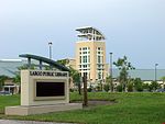
Pinellas

Pinellas is the name of a peninsula located roughly halfway down the west coast of Florida. It forms the western boundary of Tampa Bay and comprises the bulk of Pinellas County. There is a city named Pinellas Park in south Pinellas. The peninsula is bounded on the north by Pasco County, Florida, on the northeast by Hillsborough County, and on the east and south by Tampa Bay. It is bounded on the west by the Intracoastal Waterway and the Gulf of Mexico. The Pinellas peninsula connects to the south with Manatee County via the Sunshine Skyway Bridge and connects with Hillsborough County on the east via the Courtney Campbell Causeway, the Howard Frankland Bridge, and the Gandy Bridge.
Excerpt from the Wikipedia article Pinellas (License: CC BY-SA 3.0, Authors, Images).Pinellas
113th Place,
Geographical coordinates (GPS) Address Nearby Places Show on map
Geographical coordinates (GPS)
| Latitude | Longitude |
|---|---|
| N 27.876394 ° | E -82.7778579 ° |
Address
113th Place 10001
33773
Florida, United States
Open on Google Maps


