place

Union City School District (New Jersey)

New Jersey Abbott DistrictsNew Jersey District Factor Group ASchool districts in Hudson County, New JerseyUnion City, New JerseyUse American English from May 2020
Use mdy dates from May 2020
7.4.22UCNJBoardOfEdByLuigiNovi3

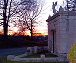
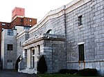
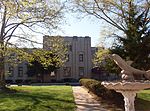
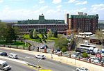
Union City School District is a comprehensive community public school district that serves students in pre-kindergarten through twelfth grade in Union City, New Jersey, United States. The district is one of 31 former Abbott districts statewide that were established pursuant to the decision by the New Jersey Supreme Court in Abbott v. Burke which are now referred to as "SDA Districts" based on the requirement for the state to cover all costs for school building and renovation projects in these districts under the supervision of the New Jersey Schools Development Authority. As of the 2018–19 school year, the district, comprised of 14 schools, had an enrollment of 13,768 students and 837.2 classroom teachers (on an FTE basis), for a student–teacher ratio of 16.4:1.The district is classified by the New Jersey Department of Education as being in District Factor Group "A", the lowest of eight groupings. District Factor Groups organize districts statewide to allow comparison by common socioeconomic characteristics of the local districts. From lowest socioeconomic status to highest, the categories are A, B, CD, DE, FG, GH, I and J.The city's single public high school, Union City High School, opened September 3, 2009, and was built on the site of the former Roosevelt Stadium. The $178 million school, whose signature feature is an athletic field on its second floor roof, replaced the former Emerson High School and Union Hill High School, which converted to middle schools.

Excerpt from the Wikipedia article Union City School District (New Jersey) (License: CC BY-SA 3.0, Authors, Images).

Union City School District (New Jersey)
39th Street,

Geographical coordinates (GPS) Address Nearby Places
placeShow on map

Wikipedia: Union City School District (New Jersey)Continue reading on Wikipedia

Geographical coordinates (GPS)

Latitude Longitude
N 40.778268 ° E -74.031458 °
placeShow on map

Address

39th Street 698
07087
New Jersey, United States
mapOpen on Google Maps

7.4.22UCNJBoardOfEdByLuigiNovi3
Share experience

Nearby Places

New Durham, North Bergen

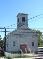
New Durham is a neighborhood in North Bergen Township in Hudson County, in the U.S. state of New Jersey. It is located near the foot of Union Turnpike and Bergen Turnpike, and south of the Tonnelle Avenue Station of the Hudson Bergen Light Rail. It is one of the few residential areas along the otherwise industrial/commercial Tonnelle Ave, and site of one of the town's main post offices. The area was the site of the colonial American community centered on the Three Pigeons when most of North Hudson was called Bergen Woods, a name recalled in Bergenwood Section on the steep slopes of the west side of the Hudson Palisades. Bergen Turnpike was one of the plank roads Hackensack Plank Road, crossing the Bergen Hill and the Hackensack Meadows that joined the village at Bergen Square with that at Hackenack that had been made the county seat of then much larger Bergen County in 1710. A congregation, established in the 1800s, still uses the name for their church.New Durham was a station stop on New York, Susquehanna and Western Railway's route into Pavonia Terminal, just north of Homestead and the Susquehanna Transfer.The Meadowview Section of North Bergen rises to the east of New Durham to the Municipal Building on Kennedy Boulevard. This neighborhood is nestled between the many cemeteries-Flower Hill Cemetery, Grove Church Cemetery, Hoboken Cemetery, Macphelah Cemetery and Weehawken Cemetery, that characterize the area and collectively constitute one of the largest green open spaces in the otherwise densely populated North Hudson area.

North Bergen station

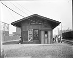
North Bergen was a railroad station in North Bergen, New Jersey, United States known Homestead for most of its existence. It as built in the mid 19th century and served by the New York, Susquehanna and Western Railway (#1059) and the Erie Railroad's Northern Branch (#1903). The station was located at the foot of the Bergen Hill at Paterson Plank Road west what is now Tonnele Avenue. The village then known as Homestead lay on western slope of lower Hudson Palisades below Schuetzen Park. The abutting village of New Durham was to the north; an eponymous station was located at what is now 50th Street adjacent to North Bergen Yard and the present day terminus of the Hudson–Bergen Light Rail at Tonnelle Avenue. Babbitt, the northernmost station in the township, was at 83rd Street.The right of way was originally developed by the Paterson and Hudson River Railroad (Erie) in the 1850s. The New Jersey Midland, a predecessor of the New York, Susquehanna and Western Railway (NYSW), built its line to its terminus a West End Junction circa 1873 and had trackage rights south of that point. Homestead was 6 miles (9.7 km) from the Erie's Pavonia Terminal on the Hudson River waterfront in Jersey City, which was originally reached by the Long Dock Tunnel, and later by Bergen Arches. Passenger service on the line was discontinued in 1966. The station house was demolished, as were most others along Northern Branch, though former station buildings along the line at Englewood, Tenafly, Demarest, Closter, and Piermont still stand. Extant station buildings from the New Jersey Midland/NYSW can be found at Wortendyke, Butler, and Newfoundland, among other places.The rail line is still used for freight transport by CSX as part of the Conrail Shared Assets Area and the NYSW mainline.