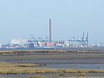
Burntwick Island
Borough of SwaleIslands of England
Burntwick Island is an island in the estuary of the River Medway in Kent, United Kingdom. It is a flat, raised area of marshland around 2 kilometres (1.2 mi) long and 1 kilometre (0.62 mi) wide among the tidal sand banks on the southern side of the estuary and separated from the British mainland of Chetney Marshes by a narrow channel known as Stangate Creek. The island is crossed by several narrow tidal channels that mean that at high tide the island is separated into several smaller islands.
Excerpt from the Wikipedia article Burntwick Island (License: CC BY-SA 3.0, Authors).Burntwick Island
Borough of Swale Upchurch
Geographical coordinates (GPS) Address Nearby Places Show on map
Geographical coordinates (GPS)
| Latitude | Longitude |
|---|---|
| N 51.421 ° | E 0.675 ° |
Address
Stansgate Spit
ME3 0EP Borough of Swale, Upchurch
England, United Kingdom
Open on Google Maps


