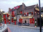
Liberty of the Clink
History of the London Borough of SouthwarkLiberties of London

The Liberty of the Clink was an area in Southwark, on the south bank of the River Thames, opposite the City of London. Although situated in Surrey the liberty was exempt from the jurisdiction of the county's high sheriff and was under the jurisdiction of the Bishop of Winchester who was usually either the Chancellor or Treasurer of the King.
Excerpt from the Wikipedia article Liberty of the Clink (License: CC BY-SA 3.0, Authors, Images).Liberty of the Clink
Southwark Bridge Road, London Borough (London Borough of Southwark)
Geographical coordinates (GPS) Address Nearby Places Show on map
Geographical coordinates (GPS)
| Latitude | Longitude |
|---|---|
| N 51.506666666667 ° | E -0.091666666666667 ° |
Address
Roman Southwark
Southwark Bridge Road
SE1 0EX London, Borough (London Borough of Southwark)
England, United Kingdom
Open on Google Maps


