Rupčine
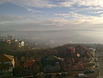
Rupčine (Serbian Cyrillic: Рупчине) is an urban neighborhood of Belgrade, the capital of Serbia. It is located in Belgrade's municipality of Čukarica. Rupčine is actually the southwesternmost part of the Žarkovo neighborhood, bordered by Bele Vode to the north, Cerak Vinogradi (that is, Ibarska Magistrala road) to the east, and the Vodovodska Street and Makiš to the west. On the south, Rupčine borders with the open fields of Stari Lanci and Novi Lanci, which stretch all the way to Železnik. Quite contrary to its eastern bordering neighborhood, Cerak Vinogradi, Rupčine is not built according to urban plans and is highly unattractive in either urban, visual or sense of communal order. Atop of all that, it has quite unattractive name too (rupčine, Serbian for big holes).
Excerpt from the Wikipedia article Rupčine (License: CC BY-SA 3.0, Authors).Rupčine
Часлава Вељића, Belgrade Београд (Чукарица)
Geographical coordinates (GPS) Address Nearby Places Show on map
 Continue reading on Wikipedia
 Geographical coordinates (GPS)
| Latitude | Longitude |
|---|---|
| N 44.743055555556 ° | E 20.396388888889 ° |
Address
Часлава Вељића 12d
11250 Belgrade, Београд (Чукарица)
Central Serbia, Serbia
Open on Google Maps