List of local nature reserves in Leicestershire

Leicestershire is a county in the East Midlands of England. The area of the administrative county is 806 square miles (2,090 km2) and the population according to the 2011 census is 980,000. Leicester City Council is a unitary authority, and the rest of the county is administered by Leicestershire County Council at the top level, with seven district councils in the second tier, Blaby, Charnwood, Harborough, Hinckley and Bosworth, Melton, North West Leicestershire and Oadby and Wigston.Local nature reserves (LNRs) are designated by local authorities under the National Parks and Access to the Countryside Act 1949. The local authority must have a legal control over the site, by owning or leasing it or having an agreement with the owner. LNRs are sites which have a special local interest either biologically or geologically, and local authorities have a duty to care for them. They can apply local bye-laws to manage and protect LNRs.As of December 2017, there are 23 local nature reserves in the county. The largest is Burbage Common and Woods at 85 hectares (210 acres), where over 300 species of flowering plants, 250 of fungi, 100 of birds, 20 of butterflies and 15 of damselflies and dragonflies have been recorded. The smallest is Lucas Marsh with 1.5 hectares (3.7 acres), a former quarry which is part of Brock's Hill Country Park. All sites are open to the public, apart from Knighton Spinney, which is only accessible on occasional open days.
Excerpt from the Wikipedia article List of local nature reserves in Leicestershire (License: CC BY-SA 3.0, Authors, Images).List of local nature reserves in Leicestershire
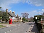
Main Street, Charnwood Swithland
Geographical coordinates (GPS) Address Nearby Places Show on map
Geographical coordinates (GPS)
| Latitude | Longitude |
|---|---|
| N 52.716666666667 ° | E -1.1833333333333 ° |
Address
Main Street
LE12 8QB Charnwood, Swithland
England, United Kingdom
Open on Google Maps


