place

Woodhouse, Leicestershire

Borough of CharnwoodCivil parishes in LeicestershireLeicestershire geography stubsUse British English from July 2015Villages in Leicestershire
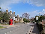
Cottage in woodhouse 2006 04 14 074web

Woodhouse, often known to locals as Old Woodhouse, is a small village and civil parish in the heart of Charnwood, England. The population of the civil parish at the 2011 census was 2,319, including around 300 term-time boarders at the Defence College. The parish includes the larger village of Woodhouse Eaves. The parish of Woodhouse was formed in 1844. The village is located between the larger Woodhouse Eaves and Quorn villages, the village contains a mixture of small cottages and large modern houses. It is a commuter village for both Leicester and Loughborough, as well as further afield. Beaumanor Hall, ancestral home of the Herrick family, was used as a listening station during the war, and intercepted signals intelligence for Bletchley Park. The Hall is now owned by Leicestershire County Council and is used as an educational base with outdoor activities.In 2005 Welbeck College moved to the village, on the edge of the grounds of Beaumanor Hall.The village has 130 homes and around 400 people living in it.The oldest part of the village is the church, St Mary-in-the-Elms, which dates back to the 15th century with 17th and 19th century renovations. On the side of the church near to where the Herrick family are buried are a number of old indentations showing where arrows were sharpened for hunting. The village was originally linear; however, the army barracks created a more nucleated village with more modern housing than the typical Georgian architecture seen throughout. The village has no services and relies on surrounding villages and towns for shops etc. The village is low on the settlement hierarchy.

Excerpt from the Wikipedia article Woodhouse, Leicestershire (License: CC BY-SA 3.0, Authors, Images).

Woodhouse, Leicestershire
Forest Road, Charnwood Woodhouse

Geographical coordinates (GPS) Address Nearby Places
placeShow on map

Wikipedia: Woodhouse, LeicestershireContinue reading on Wikipedia

Geographical coordinates (GPS)

Latitude Longitude
N 52.733611111111 ° E -1.2016666666667 °
placeShow on map

Address

Forest Road

Forest Road
LE12 8UZ Charnwood, Woodhouse
England, United Kingdom
mapOpen on Google Maps

Cottage in woodhouse 2006 04 14 074web
Share experience

Nearby Places

Quorn and Woodhouse railway station

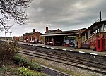
Quorn and Woodhouse railway station is a heritage station on the Great Central Railway (preserved) serving the villages of Quorn and Woodhouse in Leicestershire, England. Travelling south from Loughborough, it is the first station that is reached. Here there is a large station yard which is suitable for parking. There is also disabled access through the yard (Loughborough now has a lift for disabled as well as access via stairs). Quorn is laid out to appear as it would in the 1940s, as a typical rural LNER station. The signal box is not original but was taken from Market Rasen. The station is grade II listed and has a number of attractions, including the 1940s era NAAFI Tea Room situated underneath the station road bridge, a period Station Master's office, as well as wartime films showing in one of the waiting rooms. In 2011, a new café called Butler-Henderson Tea Rooms was opened; the building, whilst not in keeping with the station itself, complements its surroundings and provides another reason to stop off at the station. A turntable (60-foot balance model) was delivered to the station in January 2010 from Preston Docks. It had previously seen use in the ex-York Roundhouse in the days of steam. The turntable was built in 1909 by Cowans Sheldon Ltd of Carlisle. Work began on digging the foundations in June 2011 with work being completed during the late summer of that year in time for the annual Steam Railway Magazine gala in early October 2011.

List of Sites of Special Scientific Interest in Leicestershire

Leicestershire is a county in the East Midlands of England with an area of 833 square miles (2,160 km2), and a population according to the 2011 census of 980,000. Leicester City Council is a unitary authority, and the rest of the county is administered by Leicestershire County Council at the top level, with seven district councils in the second tier, Blaby, Charnwood, Harborough, Hinckley and Bosworth, Melton, North West Leicestershire and Oadby and Wigston.In England, Sites of Special Scientific Interest (SSSIs) are designated by Natural England, a non-departmental public body which is responsible for protecting England's natural environment. Designation as an SSSI gives legal protection to the most important wildlife and geological sites. As of January 2018, there are seventy-six SSSIs in the county, fifty-seven of which are designated for their biology, twelve for their geology and seven for both criteria. There are nineteen Geological Conservation Review sites, six Nature Conservation Review sites, one Special Area of Conservation, three national nature reserves, two are common land, and three contain scheduled monuments. One site is a local nature reserve, thirteen are managed by the Leicestershire and Rutland Wildlife Trust, and one by the National Trust. The largest site is Bradgate Park and Cropston Reservoir at 399.3 hectares (987 acres). It has rocks dating to the Ediacaran period around 600 million years ago, and is very important for the study of Precambrian palaeontology. The smallest is Gipsy Lane Pit at 0.5 hectares (1.2 acres), which is important to mineralogists as it is rich in sulphides, some of which are unidentified.

List of local nature reserves in Leicestershire

Leicestershire is a county in the East Midlands of England. The area of the administrative county is 806 square miles (2,090 km2) and the population according to the 2011 census is 980,000. Leicester City Council is a unitary authority, and the rest of the county is administered by Leicestershire County Council at the top level, with seven district councils in the second tier, Blaby, Charnwood, Harborough, Hinckley and Bosworth, Melton, North West Leicestershire and Oadby and Wigston.Local nature reserves (LNRs) are designated by local authorities under the National Parks and Access to the Countryside Act 1949. The local authority must have a legal control over the site, by owning or leasing it or having an agreement with the owner. LNRs are sites which have a special local interest either biologically or geologically, and local authorities have a duty to care for them. They can apply local bye-laws to manage and protect LNRs.As of December 2017, there are 23 local nature reserves in the county. The largest is Burbage Common and Woods at 85 hectares (210 acres), where over 300 species of flowering plants, 250 of fungi, 100 of birds, 20 of butterflies and 15 of damselflies and dragonflies have been recorded. The smallest is Lucas Marsh with 1.5 hectares (3.7 acres), a former quarry which is part of Brock's Hill Country Park. All sites are open to the public, apart from Knighton Spinney, which is only accessible on occasional open days.