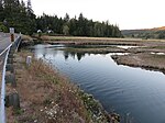
Lake Skokomish

During the Vashon Glaciation a series of lakes formed along the southern margin of the Cordilleran Ice Cap. In the Hood Canal depression, two significant lake stages existed, Lake Skokomish and Lake Hood. Early Lake Skokomish’s surface was at 350 ft (110 m) above sea level, draining across the divide at Shelton, Washington into early Glacial Lake Russell. As the glacier receded northward, this freshwater lake grew in size, until the ice was north of the Clifton channel. With the opening of the Clifton channel, the water dropped to 160 m (520 ft) above sea level. This longer and lower level lake is referred to as Lake Hood. The glacier continued to recede northward until it reached the Poulsbo channel. Here, the water level equalized to Glacial Lake Russell no longer having a separate identify.
Excerpt from the Wikipedia article Lake Skokomish (License: CC BY-SA 3.0, Authors, Images).Lake Skokomish
Geographical coordinates (GPS) Address Nearby Places Show on map
Geographical coordinates (GPS)
| Latitude | Longitude |
|---|---|
| N 47.363322 ° | E -123.127485 ° |
Address
Union
98592
Washington, United States
Open on Google Maps


