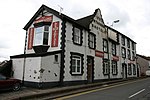
Incline Top railway station
Incline Top railway station, later Top of the Incline was a short-lived early railway station on the Taff Vale Railway in South Wales, located at Penlocks, Treharris. The station was on the original section of the line between Abercynon and Quakers Yard, which was to the left of the present-day line. The eponymous Incline was a steep gradient of 1 in 22, and trains required a stationary winding engine (installed by Brunel) to surmount it. The station was accessible only by a steep flight of steps leading to the bottom of a deep cutting in the incline. The station's life was brief and it closed after 12 years. The original line was eventually abandoned completely and replaced in 1864.After the station closed, it was left to decay until being largely destroyed by a violent cyclone on 27 October 1913, a storm, which caused considerable damage across the district, including destroying the spire of St. Mary's Church, Glyntaff. The site of the station is now overgrown with trees and is not easily noticeable.
Excerpt from the Wikipedia article Incline Top railway station (License: CC BY-SA 3.0, Authors).Incline Top railway station
A470,
Geographical coordinates (GPS) Address External links Nearby Places Show on map
Geographical coordinates (GPS)
| Latitude | Longitude |
|---|---|
| N 51.650885 ° | E -3.3181774 ° |
Address
Incline Top (Top of the Incline)
A470
CF45 4EW , Abercynon
Wales, United Kingdom
Open on Google Maps


