Sherfield Park
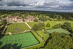
Sherfield Park, also known as Taylor's Farm, is a civil parish in the Basingstoke and Deane district of Hampshire, England. It is situated about 4 miles (6 km) northeast of central Basingstoke, to the west of the A33 road that runs between Basingstoke and Reading. The civil parish covers a housing estate that was built between 2004 and 2014 and now has 1,000 dwellings. The greenfield site had until then mainly been part of Taylor's Farm, a name which has sometimes been used for the estate. The estate was originally part of the parish of Sherfield on Loddon. Between 2008 and 2016, the area was a ward of this parish which was named Taylor's Farm. On 1 April 2016, Sherfield Park was separated to form a parish of its own, with its first parish council being elected a month later. Sherfield Park is in the borough electoral ward of Chineham and the county council division of Loddon.
Excerpt from the Wikipedia article Sherfield Park (License: CC BY-SA 3.0, Authors).Sherfield Park
Otterbourne Walk, Basingstoke and Deane Sherfield Park
Geographical coordinates (GPS) Address Nearby Places Show on map
Geographical coordinates (GPS)
| Latitude | Longitude |
|---|---|
| N 51.301072 ° | E -1.044608 ° |
Address
Otterbourne Walk
Otterbourne Walk
RG27 0SE Basingstoke and Deane, Sherfield Park
England, United Kingdom
Open on Google Maps


