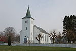
place

Holta

Rogaland geography stubsStrand, NorwayVillages in Rogaland
Holta cross
Holta cross

Holta is a small farming village in the municipality of Strand in Rogaland county, Norway. The farm is situated on the northern hills overlooking the lake Bjørheimsvatn. It is approximately 9 kilometres (5.6 mi) northeast of the village of Tau and about 4 kilometres (2.5 mi) south of the village of Fiskå. The city of Stavanger lies about 25 kilometres (16 mi) southwest of Holta (via the Ryfylke Tunnel that goes under a large fjord). On 9 August 1961, the Holtaheia Accident took place as a Vickers VC.1 Viking passenger aeroplane, G-AHPM operated by Cunard Eagle Airways, transporting schoolboys from The Archbishop Lanfranc School in Thornton Heath, London, crashed into the mountainside above the farm (Holtaheia). A total of 34 students, two teachers and three crew members were killed.

Excerpt from the Wikipedia article Holta (License: CC BY-SA 3.0, Authors, Images).

Holta
Holtavegen, Strand

Geographical coordinates (GPS) Address Nearby Places
placeShow on map

Wikipedia: HoltaContinue reading on Wikipedia

Geographical coordinates (GPS)

Latitude Longitude
N 59.0875 ° E 6.0277777777778 °
placeShow on map

Address

Holtavegen 264
4121 Strand
Norway
mapOpen on Google Maps

Holta cross
Holta cross
Share experience

Nearby Places

Strand, Norway
Strand, Norway

Strand is a municipality in Rogaland county, Norway. It is located in the traditional district of Ryfylke. The administrative centre of the municipality is the town of Jørpeland. The municipality lies across the fjord from the city of Stavanger. The Ryfast tunnel system connects Stavanger and Strand by a very long undersea tunnel. The villages of Sørskår and Fiskå are located in northern Strand, on the southern shore of the Årdalsfjorden. This area of Strand produces fruit, vegetables, and dairy products. The Fiskå Mølle (Fiskå Mill) is located in Fiskå. The larger village of Tau is located on the western coast of Strand. It is a transportation hub with ferry connections to the city of Stavanger and bus services to nearby Hjelmelandsvågen and deeper into the Ryfylke district. About 10 kilometres (6.2 mi) southeast of Tau is the municipal center of Jørpeland. This town is the largest settlement in Strand with about 7,000 people. The 262-square-kilometre (101 sq mi) municipality is the 278th largest by area out of the 356 municipalities in Norway. Strand is the 90th most populous municipality in Norway with a population of 13,474. The municipality's population density is 57.2 inhabitants per square kilometre (148/sq mi) and its population has increased by 13.4% over the previous 10-year period.The cross-country and marathon mountain biker Gunn-Rita Dahle comes from Bjørheimsbygd. She has won a gold medal in the Summer Olympics 2004, in Athens. Holtaheia was the mountain behind Holta farm where 34 school boys, 2 teachers and 3 crew died, when the Cunard Viking flight 'Papa Mike' crashed into the mountain, en route to Stavanger.

Jørpeland
Jørpeland

Jørpeland is the administrative centre of Strand municipality in Rogaland county, Norway. The town is located on the western coast of the mainland, along the shore of the Idsefjorden, about 20 kilometres (12 mi) northeast of the city of Stavanger. It sits along the Norwegian National Road 13 a short distance southeast of the village of Tau where the Ryfast tunnel has its eastern entrance. The name "Jørpeland" is composed of the slightly changed Old Norse word "jarpr", which translates to brown, and the word land ("brownland"). The reason for this name is that historically, the river Jørpelandsånå used to turn brown during times of flood.The 4.09-square-kilometre (1,010-acre) town has a population (2019) of 7,230 and a population density of 1,768 inhabitants per square kilometre (4,580/sq mi). Jørpeland is also known as "Pulpit Rock City", because Jørpeland is nearest city to the Preikestolen, which attracts tourists from all over the world. The Preikestolen is a huge cliff overlooking the Lysefjorden and it sits about 10 kilometres (6.2 mi) southeast of Jørpeland. Jørpeland became designated as a town by the municipal council on 1 April 1998. Prior to that time it was simply considered a very large village. Jørpeland is divided into nine boroughs: Leite, Barka, Tungland, Barkved, Jøssang, Førland, Langeland, Grønnevoll, and Fjelde. The river Jørpelandsåna runs through the town before emptying into the fjord on the south side of the town.