Jørpeland

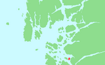
Jørpeland is the administrative centre of Strand municipality in Rogaland county, Norway. The town is located on the western coast of the mainland, along the shore of the Idsefjorden, about 20 kilometres (12 mi) northeast of the city of Stavanger. It sits along the Norwegian National Road 13 a short distance southeast of the village of Tau where the Ryfast tunnel has its eastern entrance. The name "Jørpeland" is composed of the slightly changed Old Norse word "jarpr", which translates to brown, and the word land ("brownland"). The reason for this name is that historically, the river Jørpelandsånå used to turn brown during times of flood.The 4.09-square-kilometre (1,010-acre) town has a population (2019) of 7,230 and a population density of 1,768 inhabitants per square kilometre (4,580/sq mi). Jørpeland is also known as "Pulpit Rock City", because Jørpeland is nearest city to the Preikestolen, which attracts tourists from all over the world. The Preikestolen is a huge cliff overlooking the Lysefjorden and it sits about 10 kilometres (6.2 mi) southeast of Jørpeland. Jørpeland became designated as a town by the municipal council on 1 April 1998. Prior to that time it was simply considered a very large village. Jørpeland is divided into nine boroughs: Leite, Barka, Tungland, Barkved, Jøssang, Førland, Langeland, Grønnevoll, and Fjelde. The river Jørpelandsåna runs through the town before emptying into the fjord on the south side of the town.
Excerpt from the Wikipedia article Jørpeland (License: CC BY-SA 3.0, Authors, Images).Jørpeland
Folkets Hus vegen, Strand
Geographical coordinates (GPS) Address Nearby Places Show on map
 Continue reading on Wikipedia
 Geographical coordinates (GPS)
| Latitude | Longitude |
|---|---|
| N 59.0225 ° | E 6.0408 ° |
Address
Folkets Hus vegen 11
4100 Strand, Svenskebyen
Norway
Open on Google Maps