Haugaland

Haugaland or Haugalandet is a traditional district situated on the western coast of Norway. Haugaland is one of the 15 traditional districts located within the Vestlandet region.Geographically, Haugaland is a peninsula between Bømlafjorden in Vestland county and Boknafjorden in the northern part of Rogaland county, Nord-Rogaland. It is bordered to the east of the isthmus between Ølensfjorden and Sandeidfjorden in Vindafjord municipality. It is limited by Hardangerfjorden to the north, Boknafjorden to the south, and the district of Hardanger which is located further inland. Administratively, the region of Haugaland spans slightly more than the geographic peninsula. It includes the municipality of Sveio in Vestland county and the municipalities of Haugesund, Karmøy, Utsira, Tysvær, Bokn, and Vindafjord in Rogaland. The municipality of Etne (in Vestland) is considered part of Haugaland too. The regional centre of Haugaland is the city of Haugesund. Other towns in Haugaland include Kopervik, Skudeneshavn, and Åkrehamn. As of 2015, there were 99,293 inhabitants within Haugaland.
Excerpt from the Wikipedia article Haugaland (License: CC BY-SA 3.0, Authors, Images).Haugaland
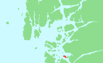
Ugelivegen, Strand
Geographical coordinates (GPS) Address Nearby Places Show on map
 Continue reading on Wikipedia
 Geographical coordinates (GPS)
| Latitude | Longitude |
|---|---|
| N 59.071 ° | E 5.9291 ° |
Address
Ugelivegen
Ugelivegen
4120 Strand
Norway
Open on Google Maps