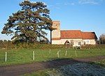
List of local nature reserves in Suffolk

Suffolk is a county in East Anglia. It is bounded by Norfolk to the north, Cambridgeshire to the west and Essex to the south. With an area of 1,466 square miles (3,800 km2), it is the eighth largest county in England, and in mid-2016 the population was 745,000. At the top level of local government is Suffolk County Council, and below it are five borough and district councils: Ipswich, East Suffolk, Mid Suffolk, Babergh and West Suffolk. Much of the coast consists of the estuaries of the Orwell, Stour, Alde, Deben and Blyth rivers, with large areas of wetlands and marshes.Local nature reserves (LNRs) are designated by local authorities under the National Parks and Access to the Countryside Act 1949. The local authority must have a legal control over the site, by owning or leasing it or having an agreement with the owner. LNRs are sites which have a special local interest either biologically or geologically, and local authorities have a duty to care for them. They can apply local bye-laws to manage and protect LNRs.As of August 2017 there are 36 LNRs in the county. Three are in Areas of Outstanding Natural Beauty, seven are Sites of Special Scientific Interest, one is a Nature Conservation Review site and two are managed by the Suffolk Wildlife Trust. The largest LNR is Sudbury Common Lands with 50.3 hectares (124 acres), which has ancient wetlands, and the smallest is Alderman Canal West at 1.0 hectare (2.5 acres), which has rare wetland flora.
Excerpt from the Wikipedia article List of local nature reserves in Suffolk (License: CC BY-SA 3.0, Authors, Images).List of local nature reserves in Suffolk
Mid Suffolk
Geographical coordinates (GPS) Address Nearby Places Show on map
Geographical coordinates (GPS)
| Latitude | Longitude |
|---|---|
| N 52.166666666667 ° | E 1 ° |
Address
IP14 2ET Mid Suffolk
England, United Kingdom
Open on Google Maps


