place

McIlroy Park

Local Nature Reserves in BerkshireNature reserves in BerkshireParks and open spaces in Reading, Berkshire
McIlroy Park 05
McIlroy Park 05

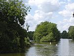
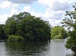
McIlroy Park is a 12-hectare (30-acre) Local Nature Reserve in Tilehurst, a suburb of Reading in Berkshire. It is owned and managed by Reading Borough Council. Along with Blundells Copse and Lousehill Copse it is part of West Reading Woodlands.

Excerpt from the Wikipedia article McIlroy Park (License: CC BY-SA 3.0, Authors, Images).

McIlroy Park
Thirlmere Avenue, Reading Norcot

Geographical coordinates (GPS) Address Nearby Places
placeShow on map

Wikipedia: McIlroy ParkContinue reading on Wikipedia

Geographical coordinates (GPS)

Latitude Longitude
N 51.4639 ° E -1.0257 °
placeShow on map

Address

Thirlmere Avenue
RG30 6XL Reading, Norcot
England, United Kingdom
mapOpen on Google Maps

McIlroy Park 05
McIlroy Park 05
Share experience

Nearby Places

Arthur Newbery Park
Arthur Newbery Park

Arthur Newbery Park is a park in Tilehurst, Reading, Berkshire. It is named after Arthur Newbery, who donated the land in 1932. It is one of Reading's oldest parks and was once part of Kentwood Common. Hollows in the park are remains of chalk and clay pits.The park slopes down to the north giving views to the River Thames and across its valley. It is mainly grass, with scattered trees, although there are small wooded areas and a play area. What is now the play area was once a pool, the pool become less popular, then neglected c. 1994.The park is of 26 acres and was once owned by Arthur Newbery, who owned and ran a high class furniture shop located at the junction of Friar Street and Queen Victoria Street in Reading town centre in trade for over forty years. On 14 September 1932, Newbery gifted the park to the mayor of Reading as an open space for the people of Reading. The great and the good were gathered on the late summer afternoon, this being a Wednesday, as it was convenient for the half day closing thus allowing members of the Council who were shopkeepers and the like to attend. Following a small lunch held at Tilehurst Congregational Church at Polsted Road the party, numbering about thirty local dignitaries, walked through the park to the hill overlooking the Thames. Here Newbery made a short speech. Newbery cited the encroaching housing development in the area as his reason for the bequest. A photograph of the occasion appeared in the Reading Chronicle on 17 September, a copy of which is held at Reading Library. The Park was originally known as Hare Moor.The park had two public air raid shelters during World War II but these have since been filled in. Rabbits can still be seen on the odd occasion running wild in the avenue of trees at the bottom bordering Oak Tree Road where Lucas Farm once stood.

Tilehurst (Reading ward)

Tilehurst is an electoral ward of the Borough of Reading, in the English county of Berkshire. It forms part of the larger Reading suburb of Tilehurst, which also includes parts of the borough's Kentwood and Norcot wards, together with the civil parish of Tilehurst Without that is outside the borough boundary in the district of West Berkshire. The ward is bordered, in clockwise order, by Norcot ward, Tilehurst Without civil parish and Kentwood ward. It lies entirely within the Reading West parliamentary constituency.As of 2016, there were just over 9,000 people living in Tilehurst ward, of whom 21% were aged under 16, 20.4% were aged 65 and over, and 10% were born outside the UK. The population lives in a total of 3,868 dwellings, of which almost 39% are semi-detached houses, around 30% in terraced houses and over 15% in detached houses. Of the population aged between 16 and 74, approximately 67% are in employment and 3.6% are unemployed. Of those in employment, 37% are in managerial, professional or technical occupations, with 16% in professional occupations.As with all Reading wards, the ward elects three councillors to Reading Borough Council. Elections since 2004 are generally held by thirds, with elections in three years out of four, although the 2022 elections were for all councillors due to boundary changes. The ward councillors are currently Meri O'Connell, James Moore and Anne Thompson, all of whom are members of the Liberal Democrat party.

Oxford Road, Reading

Oxford Road is an urban street and major arterial road in Reading, Berkshire, England, Beginning near the town centre at the meeting of St. Mary's Butts/West Street/Broad Street. The road leads west to Pangbourne, continuing eventually to the city of Oxford. The road was previously known as Pangbourne Lane.Most of the road is designated the A329. Reading West railway station is near the eastern end of Oxford Road. Tilehurst railway station is near the western end of the road, serving the Reading suburb of Tilehurst. The road to the northwest becomes Purley Rise at Purley on Thames, leading to Pangbourne. To the east in central Reading, it becomes Broad Street, the main pedestrianised shopping street in Reading. Travelling from east to west, the road passes the Broad Street Mall shopping centre before crossing the town's Inner Distribution Road on a bridge. Some 500 metres (1,600 ft) further on, Holy Trinity Church is passesd on the right, closely followed by the Oxford Road Community School at 146 Oxford Road. Battle Library is at 420 Oxford Road. The Oxford Road Community Garden is located in Western Elms Avenue, off the Oxford Road.The entrance to the Battle Hospital (closed in 2005) was located at 344 Oxford Road, where the original gate still stands. The Chatham Street development off Oxford Road, which is still under construction (as of 2010), offers possible improvement for this part of Reading with a £250 million investment scheme, including new shops, accommodation, services and leisure facilities.