place

Oxford Road, Reading

Berkshire geography stubsEngland road stubsGeography of Reading, BerkshireShopping streets in Reading, BerkshireTilehurst
Use British English from December 2016
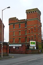
Reading West Railway Bridge, Oxford Road, Reading geograph.org.uk 1769560

Oxford Road is an urban street and major arterial road in Reading, Berkshire, England, Beginning near the town centre at the meeting of St. Mary's Butts/West Street/Broad Street. The road leads west to Pangbourne, continuing eventually to the city of Oxford. The road was previously known as Pangbourne Lane.Most of the road is designated the A329. Reading West railway station is near the eastern end of Oxford Road. Tilehurst railway station is near the western end of the road, serving the Reading suburb of Tilehurst. The road to the northwest becomes Purley Rise at Purley on Thames, leading to Pangbourne. To the east in central Reading, it becomes Broad Street, the main pedestrianised shopping street in Reading. Travelling from east to west, the road passes the Broad Street Mall shopping centre before crossing the town's Inner Distribution Road on a bridge. Some 500 metres (1,600 ft) further on, Holy Trinity Church is passesd on the right, closely followed by the Oxford Road Community School at 146 Oxford Road. Battle Library is at 420 Oxford Road. The Oxford Road Community Garden is located in Western Elms Avenue, off the Oxford Road.The entrance to the Battle Hospital (closed in 2005) was located at 344 Oxford Road, where the original gate still stands. The Chatham Street development off Oxford Road, which is still under construction (as of 2010), offers possible improvement for this part of Reading with a £250 million investment scheme, including new shops, accommodation, services and leisure facilities.

Excerpt from the Wikipedia article Oxford Road, Reading (License: CC BY-SA 3.0, Authors, Images).

Oxford Road, Reading
Oxford Road cyclepath, Reading Dee Park

Geographical coordinates (GPS) Address Nearby Places
placeShow on map

Wikipedia: Oxford Road, ReadingContinue reading on Wikipedia

Geographical coordinates (GPS)

Latitude Longitude
N 51.464 ° E -1.015 °
placeShow on map

Address

Oxford Road cyclepath

Oxford Road cyclepath
RG30 6AQ Reading, Dee Park
England, United Kingdom
mapOpen on Google Maps

Reading West Railway Bridge, Oxford Road, Reading geograph.org.uk 1769560
Share experience

Nearby Places

Chazey Court Barn
Chazey Court Barn

Chazey Court Barn is a 17th-century Grade I listed building in the town of Reading in England. It forms part of the Chazey Court Farm complex and is situated close to the Thames at the western end of The Warren in the suburb of Caversham. The barn is a large 7 bay building with a steep roof, built of red brick. It displays a very similar construction style to Mapledurham House, an Elizabethan stately home some 1.5 miles (2.4 km) to the north-west of the barn. The barn is categorised by English Heritage as being in very bad condition, subject to immediate risk of further rapid deterioration or loss of fabric, and with no solution agreed with the owners. It is not in use, and has visible structural cracking, whilst the gable has temporary shoring. In early 2020 it was reported that the owners were to be issued with a final notice by Reading Borough Council, indicating that if necessary the council would carry out the necessary works on behalf of the owner and pass on the costs to them.Work undertaken by Oxford Archaeology and using dendrochronology techniques dates the construction of the barn to 1611 or shortly thereafter, and also indicates that the other buildings of the farm complex date from a similar date or later. Research undertaken by the Oxfordshire Record Society in 1925 suggest that the farmhouse was the site of the Manor of Mapledurham Chazey, acquired in 1582 by the owners of the adjoining estate of Mapledurham Gurney in order to create the current Mapledurham estate. They surmise that the new owners, who also built Mapledurham House at around the same time, demolished the old manorial buildings and replaced them with new farm buildings.