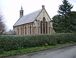
Chenies Manor House

Chenies Manor House in the parish of Chenies in Buckinghamshire, England, is a Tudor Grade I listed building once known as Chenies Palace, although it was never a royal seat nor the seat of a bishop. It was held by the Cheney family since 1180 and passed by marriage successively to the Semark and Sapcote families and thence in 1526 to the Russell family, Earls of Bedford, later Dukes of Bedford, by whom it was held for several centuries. Although the Russells soon abandoned Chenies as its main seat in favour of Woburn Abbey in Bedfordshire, Chenies parish church remains the site of the private "Bedford Chapel", the mausoleum still in use by that family.John Russell, 1st Earl of Bedford set about improving the house both as his home and enlarging it to the size and standard needed to house the royal court, so he could host visits from the king. The house was probably constructed by him around 1530–1550, while the significantly larger north range, which included the royal apartments, has been demolished. Russell had a meteoric career as an advisor to successive monarchs, becoming wealthy and titled and acquiring other properties. By about 1608 Woburn Abbey had become the principal family residence. Thereafter Chenies became increasingly neglected; the surviving buildings are the ones which were still considered practical. At the northern end of the west wing, there is an undercroft from the previous medieval manor house which occupied the same site, which is a scheduled ancient monument (SM 27145).
Excerpt from the Wikipedia article Chenies Manor House (License: CC BY-SA 3.0, Authors, Images).Chenies Manor House
Claypits Lane,
Geographical coordinates (GPS) Address Website External links Nearby Places Show on map
Geographical coordinates (GPS)
| Latitude | Longitude |
|---|---|
| N 51.674428 ° | E -0.532966 ° |
Address
Chenies Manor
Claypits Lane
WD3 6EH (Chesham and Villages Community Board)
England, United Kingdom
Open on Google Maps


